"Aliso and Wood Canyons Loop"
11 Mile loop hike
11 Mile loop hike
900' Elevation gain/loss
Moderately Strenuous
The park with its rambling name is almost 4,000 acres of former Spanish land grant ranchos hosting rolling hills, flat meadows and lush canyons and is positioned within long-walking distance from the Pacific Ocean as it overlooks the town city of Laguna Beach. What also distinguishes this park from many of its local cousins is its offer of a hike longer than just a few miles. But like any in the park, the first and third acts of these hikes are at best, a dull production. However the long second act more than makes up for that blandness.
Begin your hike at the parking lot of the Visitor Center that is worth a quick peek. Be sure to check out the fossils found in the sandstone and limestone formations that exist in the park. There’s a $3.00 parking fee, payable with a credit card. Portable toilets with hand washing facilities are adjacent to the lot. There may be running water for drinking somewhere, but I didn’t see any.
Just past the Center is the paved trailhead leading to the mouth of Aliso Canyon along Aliso Creek Trail. The paved road is actually an access for the Also Water Management Agency and as such is a private road. Its open all weekend but reportedly there have been times when its closed during the week because of work being done on the parallel running creek. This portion, or first act, of the hike is unremarkable. Families with strollers or children on bicycles will find the wide, flat road useful and pleasant to enjoy but for the hiker or mountain biker, its just whatcha gotta do to get to the good stuff.
The good stuff lies just 1.5 miles beyond the parking lot trailhead at the clearly marked trailhead for Wood Canyon Trail. I know of some hikers who will ride their bikes to this junction and lock them up on the handy bike rack located there. Portable toilets are also located here, but again, no running water.
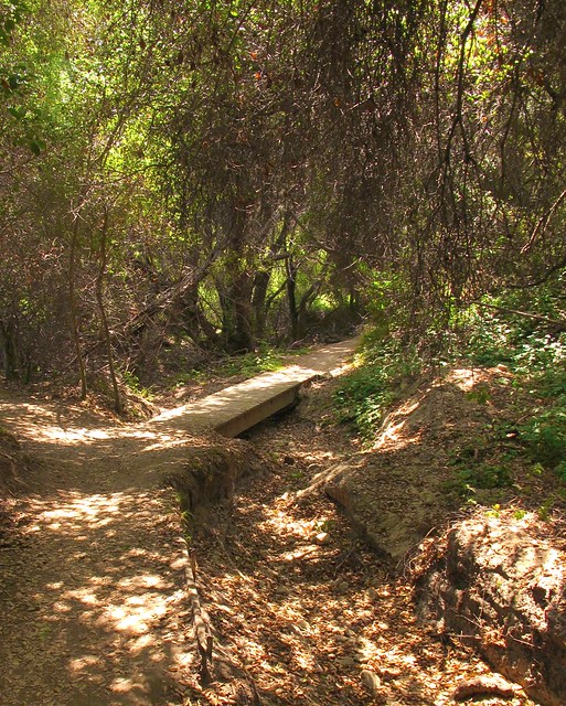
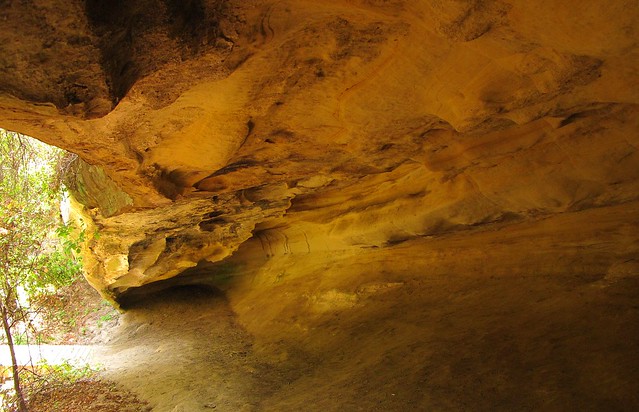
Follow Wood Canyon north for about .75 miles to the Dripping Cave junction which will be on your left and clearly marked like all of the trails at the park. It’s a short jaunt to the cave that you’ll find just beyond a wooden footbridge.
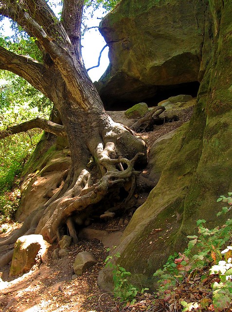
SIDE TRAIL: Before reaching Dripping Cave, you’ll see signs leading to Cave Rock, a substantial limestone formation eroded by wind and water to form several small caves. You’ll be able to see the rock if you stay on the main trail so there’s no real need to take the side trail unless you really want to.
After reading about how the cave was the supposed hideout of 19th century bandits, return towards the footbridge but instead of crossing it, veer to the left (north) trail that leads toward Mathis Canyon. The trail becomes a bit steep for about 150 yards before it drops down again into a lovely meadow residing in the bottom of Mathis Canyon. Before reaching the meadow, you’ll see even more caves as you walk beneath a cool oak canopy. After crossing the eastern edge of this canyon meadow, you’ll intersect with Mathis Canyon Trail. This is the last shade you’ll have for a while and the hike becomes much more challenging.
SIDE TRAIL: Before the climb, note the side trail to Oak Grove. Though overlooked by most, the grove resides in a narrow ravine that offers a bit of solitude from the rest of the folks on the trails. Deep and shady, I consider this a destination for a shorter, up-and-back 6-mile hike. The adjacent rock formations also make it particularly worthwhile.
Mathis Canyon Trail provides a 550’ elevation gain in approximately 1.25 miles. It’s steep with few level, catch-your-breath sections until near the very end of the climb to the West Ridge Trail. At the junction of Mathis and West Ridge, turn right (north) on the wide fire road trail. Expect lots of other folks to also be there, many of whom started at the Alta Laguna Park in Laguna Beach.
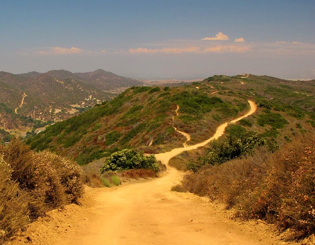
The undulating ridge is a welcome walk after the climb to reach it. The views and breezes up there contain elements of the nearby ocean making it very pleasant. Continue north on the ridge past the cell phone towers and water tank until you reach the Lynx trail on your right. Take a moment to sit on the convenient rock at this junction to retie your shoes before making the descent back into Wood Canyon. You’re about at the halfway mark of the 11 miles at this point. Parts of this downhill, single-track trail are steep and slick. Since you may also encounter bicyclists on this trail, be extra cautious.
At the bottom, you’ll intersect with Wood Canyon Trail and a right turn will bring you back to your starting point. If you brought a snack or a lunch, I’d find a shady spot here. There’s no more climbing to do, a sweet stream whispers nearby and there's lots of shade from the giant, spreading oaks found in the canyon. The entire scene makes for a nice place to regroup your thoughts, cool off from the exposed ridge and loosen up those boots if you like.
SIDE TRAIL: Hiking-only trails (Wood Creek Trail and Coyote Run Trail) parallel the main, shared use Wood Canyon trail. Signs show how to access them from Wood Canyon. The upside of using these trails is that you won’t be dodging bikers but the downside is that you may find the creek a bit further away at times and perhaps a little less shade is offered, especially on Coyote Run.
 Follow the Wood Canyon Trail southeast back towards Aliso Canyon and eventually the parking lot from where you started. The trail follows along Wood Creek that was still flowing with an impressive amount of water in August. You’ll cross the stream three times before once again reaching the Dripping Cave trail junction. From there, your hike enters its third and final act as you rejoin the paved water management access road. It’s during this last 1.5 miles that I’ll plug in my Nano and unwind as I listen to some nice music and soften my pace before reaching my car to drive home.
A tip of my Tilley hat once again to the OC Parks system. Aliso and Wood Canyons Wilderness Park did what it was designed to do; provide me with an open sky and miles to hike beneath it without having to travel far to reach it all.
Helpful Links:


