Columbia River Gorge, Oregon
6.3 miles - 1,600 elevation gain
Moderately Difficult
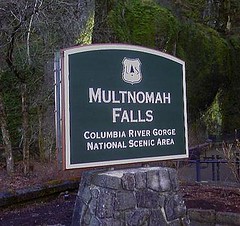 Multnomah Falls is arguably the second most recognizable feature of the Columbia River Gorge. The first is the river itself. This iconic spectacle is a popular tourist destination due to its beauty and comfortable tourist accommodations including a sit down restaurant, fully loaded gift shop, paved walkways and flush toilets. Highway access is quick and easy. There could be no better place for locals to bring visitors to Portland when wanting to truly impress them with the area’s natural beauty.
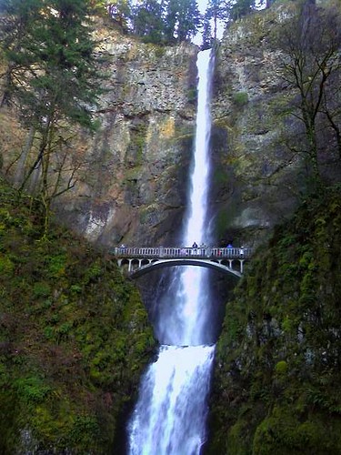
Most folks will take the ½ mile walk to the base of the first fall to peer upward from the circa 1914 concrete constructed Benson Footbridge. A number of others may even venture a bit more to peer dizzyingly over the upper fall’s cascade though it can produce some gasping breaths from those unaccustomed to steep walking. Even fewer take the opportunity to see some of the other wonderful falls higher up the gorge’s talus slopes and into the thick rainforest, which is exactly what I wanted to do during a recent trip to Portland to visit family and friends.
Depending on who you ask and which trail map you pick up, the Multnomah-Wahkenah Falls Loop hike is known either as Loop #1 or Loop #2. This map shows the route as Loop #2. Many of the hiking guides tell you to trek this in a clock-wise manner, from Multnomah Falls towards Weisendanger Falls but I would advise you to take this route in the opposite direction. Due to the crowds on the Multnomah Falls walkway (I’m hesitant to call this section a "trail," since it’s nicely paved, wide and well engineered. I spied many folks walking in flip-flops along the steep grade) I recommend saving this human traffic jam to the end of the hike. It would be a shame and misleading to allow this to set the tone for the remainder of the trek.
 The hike is well documented on other sites including; Oregon.com Multnomah Falls Guide and Tripcart.com Multnomah Falls Guide
which give varying accounts of mileage and difficulty. In rechecking my calculations, the hike with side steps to lookouts and such is right at 6 miles with an elevation gain of approximately 1,600’.
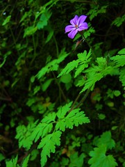
Begin and end the hike at the Multnomah Falls Lodge. From the falls proceed west, past the lodge and parking area as you parallel the Historic Columbia River Highway until you reach Wahkenah Falls. Begin your climb up the gorge’s south wall as you travel a good distance along Wahkenah Canyon creek. The canyon fills your ears with the music of the rushing creek, as moss draped pines and deep green ferns saturate your eyes. I honestly don’t think I’ve ever hiked in a more beautiful forest setting.
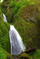
 The climb up-canyon continues for about 2.7 miles until it levels off on the southern slope of the gorge. Along the way you’ll discover Fairy Falls, a lovely fan waterfall that invites many photos to be taken. Near the high point of the hike, you’ll have opportunities to visit Devils Rest, another 1.6 miles and Larch Mountain, an additional 5 miles from the trail junction.
When you begin to descend north along Multnomah Creek, several more small waterfalls are found including Wiesendanger and Ecola falls. Though the scenery remains spectacular, it is along this section of trail that you’re likely to encounter more hikers who’ve come up from Multnomah Falls, the number of which will increase to distraction and irritation until you reach the main lodge again.
I’m definitely repeating this hike on subsequent visits to the area but will also strive to summit
 Larch Mountain next time. From the photos and trail guides I’ve read, it should prove to be a rewarding experience. The top of the mountain is similar to a bald; unprotected by trees thereby offering unobstructed views for miles in all directions.
In addition to the other charms of the area, both in terms of the inhabitants and environs, this hike will be just one more reason to return. And soon.