
Monday, March 24, 2014
Monday, March 10, 2014
The "Go Bag" - Day Hike Ready, Willing and Able!

These two bags are carried in the back of the car and on business trips in the event that the opportunity to take in a short, afternoon hike of a few miles before sunset presents itself. When traveling by air, I often leave the toiletries home and replace my preferred, standard trekking pole for a collapsible one which fits into luggage more easily. Though it's likely obvious from the top photo, I always, always carry a hat. Carried generally on the outside of the bag is my trusty Tilley hat. I consider Tilley to be the best outdoor adventure hat available. The extra ballcap that's kept in the clothing bag is worn after the hike is over and the Tilley is sweat soaked.

A. Mountain Smith Tour lumbar pack. It’s been accessorized with shoulder straps. The yellow interior makes it easy to find things inside without having to search through a normally dark interior.
B. Aluminum Emergency Whistle.
C. I’ve added a waist strap zippered pocket to carry lip balm, extra sunscreen and a few Jolly Rancher candies to suck on while hiking. This one was picked up at a running supply outlet and I like its small size. Similar zippered pouches can be found at outdoor gear stores but they're generally larger in size.
D. Trail Snacks which include fun size Payday candy bars. Quick sugar, a little protein and they don’t melt. Probably not the best option, but they’re inexpensive compared to some pricey energy bars which generally aren’t that different overall.
E. Compass, notepad, pen (and generally a pencil stub) and a trail guide and/or map, folded and glued into the notepad.

F. First Aid Kit, supplemented with blister pads, NSAID pain relievers, tick removal tool, tweezers and emergency sutures. Headlamp and sometimes a separate small handheld LED flashlight. Matches that have been waterproofed and an extra mini-carabiner for reasons I’ve not determined yet. An alternative to matches is a small butane cigarette lighter.
G. Duct tape, emergency blanket, moist towelettes and an ACE bandage secured with safety pins.
H. Collapsible trekking pole (packed when there’s air travel involved).
Not shown is a folding knife (it was in my pocket) and signal mirror (it was in a separate pocket of the pack that I forgot to look in at the time), extra batteries (carried if it is going to be a long hike), some cash and a photo copy of my driver’s license and emergency contact information.
Additional items that I sometimes carry in the Go Bag include a lighweight poncho, extra water, face towel and a clean shirt.
Every few months, take some time to replenish the trail snacks, medicines and moist towelettes. Check the expiration dates on insect repellent and sunscreen. Also, clean the items if they've been used frequently as well as their condition. Not a pleasant experience to find that your pack has a frayed strap or that your water bottles leak during a hike.
Monday, December 30, 2013
Mid Winter in the OC: A day hike at Caspers Wilderness Park
Loop Hike: Bell Canyon – Quail Run – East Ridge – Sun Rise – Star Rise – Oak Trail – Bell Canyon
3.8 miles
400 foot elevation gain/loss
Moderately Easy
During the winter months, it is difficult to not call my
relatives and friends living in places with proper four-season weather and
complain about the local temperatures dropping to the high 50’s. Observations
that I may need to wear long trousers or socks because of the obvious frigid
Southern California conditions are often met with telephonic silence or
low-toned curses as they relate the daily slogs through hip-high snow drifts,
black ice, freezing fog (a real thing) or at best, gray skies accompanying
temperatures in single digits.

But along with the ever-present threat of earthquakes,
autumnal raging wild fires and freeways that generally resemble parking lots,
Southern California hosts the mildest winter weather I’ve ever encountered.
This includes the Florida Keys, Hawaii, and Central Arizona. If you’re reading
this from someplace other than Southern California, don’t hate us because we’re
beautiful in the winter, just make it a point to experience it yourself. While
here, you’ll also find that despite the millions of people who have decided to
call this place home, there is a lot of open space.
Orange County, California is one such place. In addition to renowned coastal destinations,
the county adorns itself with regional and wilderness parks within a short
drive of Disneyland, high-end shopping plazas and historical landmarks such as
Mission San Juan Capistrano. Just 15 minutes east of the Mission (truly a
worthy destination in and of itself) along the Ortega Highway rests Caspers
Wilderness Park. As I’ve mentioned in
earlier posts, Caspers is probably my favorite local hiking location in the OC
Park system.
The trails are well marked and maintained, the Nature Center
is nicely put together and staffed by the friendliest rangers and volunteers,
informative programs occur most weekends and it’s close. It is the go-to
wilderness park to take out of town visitors who have grown weary of wearing
mouse ears and never ending highway construction delays. To a person, they’re taken aback by the
beauty and solace held within the 8,000-acre park. Most of the hikes here aren’t very lengthy.
While it is possible to create a 14+ mile trek by combining a few trails
together, most of them are about 3-6 miles long. For me, that’s the sweet spot
for a weekend day hike.
So it was, on a late December, post-solstice weekend that the
temperatures hovered in the mid-70’s. After a leisurely morning of coffee,
baked frittata and catching up with the Sunday funnies the decision to head to
Caspers was made. Since the park is so close, there was time to pack a
post-hike picnic of chicken salad, good cheeses and fruit. Today would offer a chance to further
distance oneself from the Holiday stressors, get some quiet time with some
trees and dirt paths.
But rather than returning to a well remembered, but favored
loop hike, a new one was sought. After a quick visit to the OC Park website to
review their online and printable trail map, the day’s short hike was decided
upon.
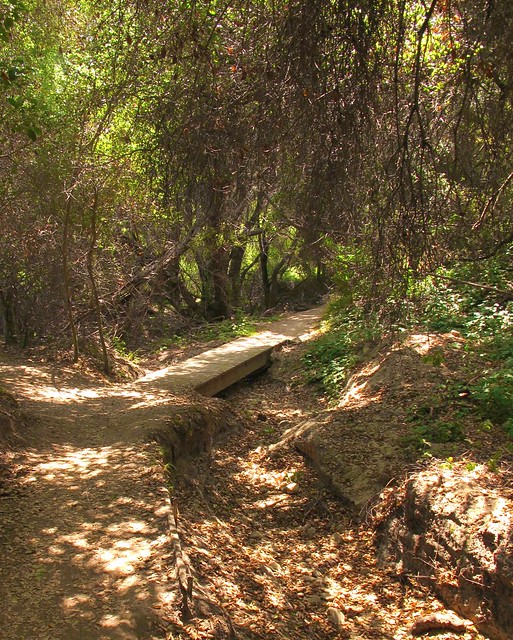
The best way to describe the almost 4-mile loop is to list
the various trails from which it is composed: Bell Canyon – Quail Run – East
Ridge – Sun Rise – Star Rise – Oak Trail – Bell Canyon.
After entering the park, head north to the Old Corral parking
area. Giant oaks shade a number of picnic benches; this is where you’ll have
your picnic afterwards. The Bell Canyon trailhead is just a few hundred yards
north of there, at the end of the paved roadway. Continue north for a few more
hundred feet until you come to the Quail Run trail.

Quail Run heads southeasterly (a right turn off of Bell
Canyon trail) and begins a moderate climb to the East Ridge trail. After little
over one-half of a mile and about a 300+/- elevation gain, turn left (north) on
the East Ridge trail. The views along the undulating ridge are sweet to savor
as you look 360 degrees into mostly unspoiled inland foothill territory.
Due west lies the white sandstone and kaolin
clay bluffs that skirt the edge of the West Ridge trail, north one sees
Santiago Peak, eastern views reveal the Ortega Highway corridor and the rolling
Santa Ana foothills and behind you to the south it is easy to spy the alluvial
courses leading to the ocean. The ridge
is relatively exposed and on a warm, sunny day you’ll be glad you’re wearing
sunscreen and a hat. Short scrub and prickly pear cactus festoon either side of
the trail that drops off sharply on either side.
The wide ridge trail borders the eastern edge of Bell Canyon
below in which there are spreading oaks and broad meadows. In the spring and
early summer, these meadows are lush and green. In the winter, they appear to
be softly gray but not unappealing to the eye.
Continue along the ridge until 1.5 miles when the trail
intersects with the Sun Rise trail. Turn west (left) onto this short but very
steeply descending trail as it places you right in the middle of Bell
Canyon. At the 2-mile tick, Sun Rise
meets up with Bell Canyon trail. Follow this trail south (left) as you begin
the return portion of this loop hike.
 What’s nice about Caspers is that the interconnecting trails
provide multiple route options and soon you’ll be faced with one. At 2.25 miles, you’re given the choice of
continuing along Bell Canyon or veer off a bit on the Star Rise trail. The hike
is shortened a bit if you continue along Bell Canyon, but I highly suggest
taking Star Rise so you can hike upon what is arguably the most beautiful trail
section in Orange County: The Oak Trail.
What’s nice about Caspers is that the interconnecting trails
provide multiple route options and soon you’ll be faced with one. At 2.25 miles, you’re given the choice of
continuing along Bell Canyon or veer off a bit on the Star Rise trail. The hike
is shortened a bit if you continue along Bell Canyon, but I highly suggest
taking Star Rise so you can hike upon what is arguably the most beautiful trail
section in Orange County: The Oak Trail.
The Oak Trail is aptly named as you walk beneath the cool
shade of wildly twisting branches of centuries-old oaks. This section of trail
(approximately 1 mile) is peacefully calming and embracive. A handful of inviting benches allow you to
take it all in and if you have the notion, accept the invitation gratefully.
 The trail emerges from the shade as you cross a dry stream
bed and onto the Nature Trail. Soon you’re provided another option to follow it
back to the Old Corral parking area or rejoin the Bell Canyon trail as it takes
you directly to the original trail head.
The trail emerges from the shade as you cross a dry stream
bed and onto the Nature Trail. Soon you’re provided another option to follow it
back to the Old Corral parking area or rejoin the Bell Canyon trail as it takes
you directly to the original trail head.
Depending on how many side tracks you take, the entire loop
is a little under 4 miles with an overall elevation gain and loss of almost 400
feet. Not a difficult hike but a pleasing one that reminds you of why you chose
to live in the OC.
Tuesday, May 15, 2012
Soldiers Pass - Brins Mesa Loop; Sedona Magic
~ 6 mile loop
800' Gain/Loss
Moderate Difficulty
Even for non-believers, Sedona is magical. The supposed swirling energy vortexes that
dot the area are truly no match for the sheer magic and beauty of the hematite
(iron oxide) laden sandstone red rock (known as the Schnebly Hill Formation) framed by lighter bands of limestone. Once
viewed, it is easy to see why these red rocks would easily inspire a spiritual
response even to the most stoic, jaded visitor.
 This inspiration is not isolated only to the artist, mystic
or seeker of the sacred. For the hiker, Sedona is likely to create a sense of
unabashed awe. Guidebooks point to at
least 150 trails, loops and cross-country treks with more being established
every year. Though Sedona proper encompasses only 19 square miles of land, its
trekable environs reach well beyond the city limits.
This inspiration is not isolated only to the artist, mystic
or seeker of the sacred. For the hiker, Sedona is likely to create a sense of
unabashed awe. Guidebooks point to at
least 150 trails, loops and cross-country treks with more being established
every year. Though Sedona proper encompasses only 19 square miles of land, its
trekable environs reach well beyond the city limits.
To deal with the overwhelming decision of what trail to
tackle, there is no better place to stop than The Hike House. Located near the intersection of highways 89A and 179, their sage advice and
“Sedona Trail Finder” computer program will help you find the right hike,
practically customized for just for you.
They also have a nice gear and clothing store. Their snack shop is a good place to energize the body before or after a hike. Don’t miss this
place.
For this trip, the Soldiers Pass – Brins Mesa – Cibola –
Jordon Trail loop was selected. With a total mileage of about 6 miles and an
elevation change of about 800 feet, this loop offers views, natural arches,
sinkholes, sacred pools and a trek along a high mesa.

The trailhead is accessed by taking Soldiers Pass Road off
of Hwy 89A, following it northerly through a subdivision until it intersects
with Rim Shadows Road. Make a right and look carefully to the left as you drive
on Rim Shadows for the small, but well established trailhead parking lot.
Though others have stated otherwise, according to the Hike House and the most
recent map I have, a Red Rocks Parking Pass (available at Ranger Stations and
Hike House) is not required here as it is in many other trailhead parking lots. The lot can and often fills during peak hours and is locked after 6:00 pm. If
you do find yourself behind the locked gate, it will automatically open when
approached in a car.
Follow trail signs for the Soldiers Pass Trail as it
parallels and crosses some wide jeep trails. Stay to the left of the Jordan
Trail intersection as you step up to the Devils Kitchen, the only natural
sinkhole in Sedona. Continue on until
you reach the Seven Sacred Pools, a series of naturally carved pools created by
runoff from the surrounding terrain.
The pools generally have some water in them year-round and
wildlife frequent them in the early mornings and late afternoons. This is where you will likely see the crowds
thin out and won’t see any jeeps again until the end of the hike. Red rock cliffs adorn on either side of the
trail which makes it difficult to concentrate on the path before you.
A little more than a mile from the trailhead you may notice
a side trail located just past a posted metal Forest Service Wilderness sign on
your right. If you follow this well marked trail, (often blocked with stones
and branches) you’ll be treated to a number of arches and alcoves on the side
of the opposite mesa. The trail leads to a slick rock ledge and then sharply up
just shy of one third of a mile to a series of three arches.
 Returning again to the Soldiers Pass trail, you’ll
soon begin to climb more steeply up a single track to the top of Soldiers Pass,
topping out at about 2.2 miles from the trailhead. I highly suggest that before you work your
way up along a ridge to the top of Brins Mesa, stop and look behind to look
down into Soldiers Creek Valley, the town of Sedona and Bell Rock in the
distance. At the Soldiers-Brins
intersection, turn right towards the top of and across Brins Mesa.
Returning again to the Soldiers Pass trail, you’ll
soon begin to climb more steeply up a single track to the top of Soldiers Pass,
topping out at about 2.2 miles from the trailhead. I highly suggest that before you work your
way up along a ridge to the top of Brins Mesa, stop and look behind to look
down into Soldiers Creek Valley, the town of Sedona and Bell Rock in the
distance. At the Soldiers-Brins
intersection, turn right towards the top of and across Brins Mesa.
The walk across the mesa is easy as you pass skeletons
of large trees surrounded by abundant new growth oaks and cypress. This forest
is rebounding wildly from a devastating fire in 2006. To the north and east, you’ll be treated to
views of Mormon Canyon,
Schnebly Hill and Mitten Ridge. Soon the trail will lead to the edge of Brins
Mesa and then drops sharply to a series of natural stone steps and a gravel strewn,
slippery path into Mormon Canyon.
Follow
Brins Mesa Trail until you encounter a parking lot (the Brins Mesa/Jordon Trail
trailhead) located about 2 miles from the Soldiers Pass intersection. Before
reaching the lot, look right for the Cibola Pass trail and make the sharp right
as it traverses towards Cibola Rock, an unusual formation that will eventual rise northeast of your position.
After
almost a mile, keep an eye out for trail signs that leads to the Jordan
Trail. My trail map did not include some
newly developed trails, Javelina and Ant Hill to name two, so be mindful that
you don’t take an unplanned side trip.
The Jordon
Trail continues about .7 miles further where it meets up with the Soldiers Pass
Trail, just south of the Devils Kitchen. Turn left onto Soldiers Pass and
follow it for about a half mile to your starting point trailhead parking lot.
The hike
is a moderate one with a few steep climbs, jaw-dropping views and satisfying
day hike mileage. A quick Google search
will give you numerous sites that also outline this hike, but I recommend a
visit to David Creech’s hiking blog, featured below, as well as a stop to the
Hike House for additional maps and friendly guidance.
Any visit
to Sedona will undoubtedly result in the desire to return, explore further and
discover so very much more. Perhaps you might also find a missing piece of
yourself that you never knew was gone. Sedona
is like that.

Tuesday, January 17, 2012
Deer Springs to Suicide Rock Trail Report: Memories Renewed

Moderate Difficulty
1850 Elevation gain/loss
There are views, trees and trails that exist in a hiker's memory forever. It is difficult to describe to someone who may not frequent the outdoors or backcountry, but for many who seek out dirt paths and open skies, these places and things have a special hold on us. Not unlike a special song that resides in the soundtrack of a person's life, it is possible for a hiker to recall with extreme clarity when, where and with who he or she was with on a particular trek. All it takes is a particular vista or bird song or vanilla-scent pine bark or the taste of dust on your tongue or the weight of a pack to bring all of it into focus.
For me, those moments are deeply rooted in the San Jacinto mountains. Located due west of Palm Springs, it was in those mountains and on those switchbacks where I learned a great deal about the wilderness, and about myself. For me, these rugged peaks are personal touchstones for so much of my life.
John Muir called the San Jacintos Southern California's own "range of light" since they are very similar in geology, climate, appearance and altitude to the Sierras. In fact the same forces that created it's northern cousins are responsible for the San Jacinto wilderness area.
My first excursion into this area was at age 13 climbing the Devil's Slide Trail to Skunk Cabbage Meadow. A relatively short hike but as anyone who's hiked the Devil's Slide, the 2.5 mile climb from Humber Park to the Saddle is notoriously steep for a beginning hiker and due to its popularity, a bit over-loved.
 It certainly isn't the only way up, and though at one time I could easily boast that I had hiked every trail in the system in the area, there was one exception, the Deer Springs trail. That is no longer the case and I truly regret for not correcting that experience gap many years ago. Deer Springs is a sweetheart of a trail and highly recommended for anyone visiting and hiking the Idyllwild area.
From Deer Springs, one has access to the entirety of what these mountains have to offer, including San Jacinto peak, Round Valley and and all the rest without having to deal with an overly crowded parking area, heart breaking hiker limits or endless switchbacks that is the hallmark of Devil's Slide. For sure, it takes a few more steps to gain altitude, but the more moderate elevation gain allows a hiker to perhaps enjoy the scenery a bit more.
Last October was my first time on the trail with an inaugural trek to Suicide Rock. It occurred to me that the last time I had even visited Suicide Rock was via a face climb. But that was 35 years and 35 pounds ago. I prefer walking sticks to carabiners these days. Accessing the top of Suicide Rock via this route was just as satisfying as the face climb done so long ago.
The trailhead is located directly across the street from the San Jacinto Nature Center, about a mile north of the small mountain community of Idyllwild. A turnout serves as the parking area with the trail leading quickly away from the adjacent highway noise. Follow the wide and well marked trail for about .5 miles after which you'll enter the San Jacinto Wilderness. You'll need a wilderness permit to enter the area from that point on. Unlike the Devil's Slide trail, you'll have no problem getting a permit for this trailhead at the ranger's station in Idyllwild the day before or even the morning of your hike. The only restriction is that your group is no larger than 12 hikers per permit.
 The trail is a steady but manageable climb from 5,600 feet to an eventual 7,450 elevation on top of Suicide Rock. Oaks and Mazanita will give way to magnificent Incense Cedar and Maidenhair Ferns as you near the Suicide Rock Junction 2.25 miles from the starting point.
Follow the signs to Suicide Rock another 1.25 miles on. A left turn at the junction leads to San Jacinto peak, but I'll leave that destination for another day.
Many of the trail guides you'll read will tell you that after the steady climb to the junction, the trail flattens and the mileage is right at or just below a mile to the Rock. Don't believe it. The trail continues to climb, albeit rolling but steep in parts, for the longest mile in hiking history. In other words, if you think the hard part of the hike is over when you reach the junction, it's not. Expect more of the same that you've already hiked to this point and you won't be too surprised or discouraged with the remaining section of trail.
The views from Suicide are spectacular. It affords a clear view of Tahquitz Rock, the town of Idyllwild and miles of flatland laying westerly towards the ocean. There are plenty of places on bare, flat rock, exposed to the sky, perfectly suited for gazing heavenly or spreading out a lunch. It's advised to be on the lookout for rattlers nesting in wide cracks on top of the bald, however. On the day we visited, a total of 6 of the snakes were spied, two of them coiled together and as large as a fire hose. They were content to let us visitors to have our time taking all of it in before returning the way you came for a nearly 7 mile round trip hike in Southern California's own alpine ruggedness.
 The Deer Springs Trail is highly recommended as a convenient and lovely access to the wonderful peaks and valleys above Idyllwild. Don't pass it up just because it may add a mile or two to your destination. The extra trail time is well worth it.
Amazingly detailed plant guide following the entire trail: Deer Springs Plant Guide
Park Guide and Permit Information: San Jacinto State Park Guide
Sunday, August 14, 2011
Aliso and Wood Canyons: A hike in 3 acts

"Aliso and Wood Canyons Loop"
11 Mile loop hike
11 Mile loop hike
900' Elevation gain/loss
Moderately Strenuous
The park with its rambling name is almost 4,000 acres of former Spanish land grant ranchos hosting rolling hills, flat meadows and lush canyons and is positioned within long-walking distance from the Pacific Ocean as it overlooks the town city of Laguna Beach. What also distinguishes this park from many of its local cousins is its offer of a hike longer than just a few miles. But like any in the park, the first and third acts of these hikes are at best, a dull production. However the long second act more than makes up for that blandness.
Begin your hike at the parking lot of the Visitor Center that is worth a quick peek. Be sure to check out the fossils found in the sandstone and limestone formations that exist in the park. There’s a $3.00 parking fee, payable with a credit card. Portable toilets with hand washing facilities are adjacent to the lot. There may be running water for drinking somewhere, but I didn’t see any.
Just past the Center is the paved trailhead leading to the mouth of Aliso Canyon along Aliso Creek Trail. The paved road is actually an access for the Also Water Management Agency and as such is a private road. Its open all weekend but reportedly there have been times when its closed during the week because of work being done on the parallel running creek. This portion, or first act, of the hike is unremarkable. Families with strollers or children on bicycles will find the wide, flat road useful and pleasant to enjoy but for the hiker or mountain biker, its just whatcha gotta do to get to the good stuff.
The good stuff lies just 1.5 miles beyond the parking lot trailhead at the clearly marked trailhead for Wood Canyon Trail. I know of some hikers who will ride their bikes to this junction and lock them up on the handy bike rack located there. Portable toilets are also located here, but again, no running water.
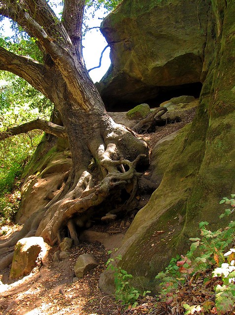
Follow Wood Canyon north for about .75 miles to the Dripping Cave junction which will be on your left and clearly marked like all of the trails at the park. It’s a short jaunt to the cave that you’ll find just beyond a wooden footbridge.
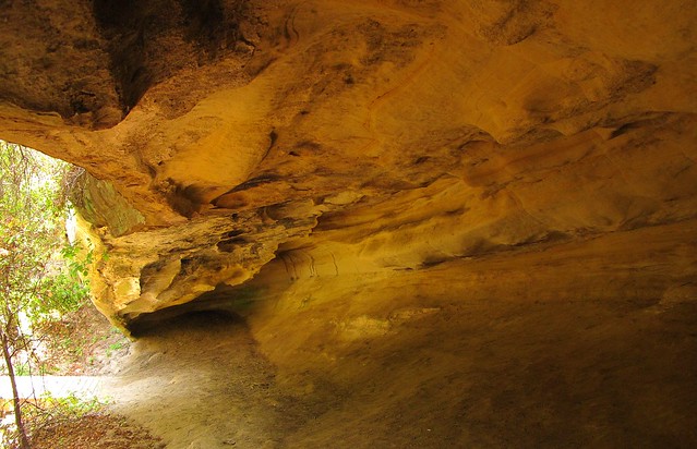
SIDE TRAIL: Before reaching Dripping Cave, you’ll see signs leading to Cave Rock, a substantial limestone formation eroded by wind and water to form several small caves. You’ll be able to see the rock if you stay on the main trail so there’s no real need to take the side trail unless you really want to.
After reading about how the cave was the supposed hideout of 19th century bandits, return towards the footbridge but instead of crossing it, veer to the left (north) trail that leads toward Mathis Canyon. The trail becomes a bit steep for about 150 yards before it drops down again into a lovely meadow residing in the bottom of Mathis Canyon. Before reaching the meadow, you’ll see even more caves as you walk beneath a cool oak canopy. After crossing the eastern edge of this canyon meadow, you’ll intersect with Mathis Canyon Trail. This is the last shade you’ll have for a while and the hike becomes much more challenging.
SIDE TRAIL: Before the climb, note the side trail to Oak Grove. Though overlooked by most, the grove resides in a narrow ravine that offers a bit of solitude from the rest of the folks on the trails. Deep and shady, I consider this a destination for a shorter, up-and-back 6-mile hike. The adjacent rock formations also make it particularly worthwhile.

Mathis Canyon Trail provides a 550’ elevation gain in approximately 1.25 miles. It’s steep with few level, catch-your-breath sections until near the very end of the climb to the West Ridge Trail. At the junction of Mathis and West Ridge, turn right (north) on the wide fire road trail. Expect lots of other folks to also be there, many of whom started at the Alta Laguna Park in Laguna Beach.
The undulating ridge is a welcome walk after the climb to reach it. The views and breezes up there contain elements of the nearby ocean making it very pleasant. Continue north on the ridge past the cell phone towers and water tank until you reach the Lynx trail on your right. Take a moment to sit on the convenient rock at this junction to retie your shoes before making the descent back into Wood Canyon. You’re about at the halfway mark of the 11 miles at this point. Parts of this downhill, single-track trail are steep and slick. Since you may also encounter bicyclists on this trail, be extra cautious.
At the bottom, you’ll intersect with Wood Canyon Trail and a right turn will bring you back to your starting point. If you brought a snack or a lunch, I’d find a shady spot here. There’s no more climbing to do, a sweet stream whispers nearby and there's lots of shade from the giant, spreading oaks found in the canyon. The entire scene makes for a nice place to regroup your thoughts, cool off from the exposed ridge and loosen up those boots if you like.
SIDE TRAIL: Hiking-only trails (Wood Creek Trail and Coyote Run Trail) parallel the main, shared use Wood Canyon trail. Signs show how to access them from Wood Canyon. The upside of using these trails is that you won’t be dodging bikers but the downside is that you may find the creek a bit further away at times and perhaps a little less shade is offered, especially on Coyote Run.
 Follow the Wood Canyon Trail southeast back towards Aliso Canyon and eventually the parking lot from where you started. The trail follows along Wood Creek that was still flowing with an impressive amount of water in August. You’ll cross the stream three times before once again reaching the Dripping Cave trail junction. From there, your hike enters its third and final act as you rejoin the paved water management access road. It’s during this last 1.5 miles that I’ll plug in my Nano and unwind as I listen to some nice music and soften my pace before reaching my car to drive home.
A tip of my Tilley hat once again to the OC Parks system. Aliso and Wood Canyons Wilderness Park did what it was designed to do; provide me with an open sky and miles to hike beneath it without having to travel far to reach it all.
Helpful Links:
Monday, June 6, 2011
Whiting Ranch; Red Rock, Blackened Oak.

The best way to appreciate nearby trails and countryside is to view it all as a tourist would. You’re likely to discover surprising new things and places about your local environs that you might’ve missed otherwise.
There are places in Orange County that, if you squinted and shielded your eyes, closely resemble the sandstone cliffs in southern Utah or parts of Arizona. Such is the case with Whiting Ranch in Orange County, California.
There are places in Orange County that, if you squinted and shielded your eyes, closely resemble the sandstone cliffs in southern Utah or parts of Arizona. Such is the case with Whiting Ranch in Orange County, California.
Okay, so they’re not quite as impressive, grand or awe inspiring as Zion, Sedona or Moab but if you live in southern California, there are places of exquisite geological beauty practically in your back yard. If you know where to look.
 The Orange County Wilderness Park area known as Limestone Canyon/Whiting Ranch is comprised of over 4,000 acres of rugged hillsides, narrow canyons and unique rock formations in the foothills east of the OC suburban sprawl. Narrow tentacles of the park lay between housing developments and immediately adjacent to shopping centers and freeways creating an almost surreal experience for the hiker or mountain biker. Within 10 minutes of turning your back to a busy McDonald’s and Target, you’ll find yourself walking under the canopy of centuries old oaks and shady sycamores with only a hint of the city heard on the wind.
One of the more popular hikes is to visit the Red Rock Canyon. Beginning on the Borrego Trail, this 5-mile up and back hike allows you to experience a few of the rare sandstone cliffs that can be found in the county. The trailhead begins literally adjacent to a large shopping center and winds its way through a canyon between two ridges filled with expansive home sites. For the first ¾ mile, you’ll catch glimpses of those homes, many of which were damaged by the 2007 wildfire that nearly decimated large sections of the park.
Evidence of the fire is clearly seen with the presence of blackened oaks and thick layers of hardened ash still found in the soil throughout this portion of the park. The canyon and its oaks are recovering in remarkable fashion and as many naturalists will attest, such events are beneficial to the long term health of this wilderness.

The hike to Red Rock Canyon is moderately easy and about half of it is in the shade. As you leave the Portola Parkway parking lot ($3.00 fee) the trail immediately leads you into a riparian environment that is surprisingly lush for what is generally considered a very dry wilderness. You'll immediately be struck with the sight of blackened oaks, now festooned with new, green leaves and fresh branches as the trees attempt to reclaim their former stateliness. Before a mile has been traveled, an oak flat welcomes you to take in the increasing canopy and the view of a cave on the east wall of the Borrego Canyon trail. Though inviting, I'd recommend skipping it since it is well protected by a thick, moist green moat of poison oak.
The trail continues northeasterly as it leaves the shady oaks through often dry sandy washes bordered by chaparral and low scrub. At about 2 miles, the Borrego Trail junctions with the Cattle Pond and Mustard Road trails. Watch the trail markers carefully to find the Red Rock trail that parallels Mustard Road. This single track trail is located just beyond a picnic table equipped rest area and easy to miss. If you come to the Billy Goat trail junction, you've gone too far.
Follow the narrow Red Rock trail as it continues north towards a number of sandstone cliffs found at the end of another shadeless sandy wash. Anticipate being a little wowed when the cliffs are encountered for the first time. It will be difficult to imagine that you're in the same county as the Real Housewives, Disneyland and vast expanses of bedroom communities, condos and strip malls.
 Please be respectful of these fragile formations and don't climb the cliff walls. Take some photos, enjoy a handful of trailmix and pick up the trash left by the guy who visited an hour before you. This kind of hiking destination demands a little extra effort to protect and maintain. Once you've taken in the unique vibe of the place, return the way you came to your car or make a left at the Mustard Road trail junction to explore more of the wilderness park.
When I hike this fun trail, I'm reminded how fortunate I am to have such an interesting place right down the road a bit, just past the Walmart and Arco station. If you live in the area, don't miss it and if you've got visitors from out of town anxious to visit the land of the Mouse, convince them that Mickey will wait and bring them here first.
The links below will lead you to a trail map and to the OC Parks website relating to this park. Also note the link to flickr pages of the album of my photos of the park.
Whiting Ranch Photo Album; Flickr
Thursday, May 5, 2011
Willow Dells Loops - Prescott, AZ: Big Rocks, LIttle City
 An initial evaluation of Prescott, Arizona wouldn't necessarily result in categorizing it as a hiking destination city. Until I really explored the area, I held a similar view of what is by any other gauge a really nice place to visit. Prescott's about a 90 minute drive north from Phoenix and maybe an hour south of Sedona.
 The city's got plenty of good places to eat, reasonable and clean places to sleep and other ways to spend your money. Its elevation places it in a transition zone between desert and pine forest mountains, including national forest land.
But what made me change my mind about Prescott and actually recommending it as a hiking city was my discovery of the Willow Dell Loops. This short (3.8) but spectacular day hike is comprised of two loops that take the hiker or adventurous mountain biker through a maze of gigantic boulders, narrow granite draws and surprisingly lush, creek-fed meadows.
The trail is but one of several within the city's Mile High trail system that is being expanded every year. Because of the transitional elevation (5,100 +/-) and adequate rainfall and snow melt from the nearby mountains, you'll encounter a wide variety of plant life, from cactus to scrub oak to fir to pine trees.

Don't pass up the side trail to The Apex. Wonderful views are gained by scrambling the 1/2 mile to the highest point in this portion of the Dells. The Apex trail crosses over boulders and wide sections of bare rock, the trail being marked by a series of white dots painted onto the rock. It should be noted that all of the trails here are similarly marked as it meanders over granite outcroppings and ledges. Keep an eye out for these markings since it could be easy to lose the trail if you're not remaining observant.

Coupled with the nearby national forest trails, the dozen or so city trails and those found in Sedona, Prescott makes a fine place for hikers to visit and stay for a while. If you're planning a trip to the Grand Canyon or other portions of northern Arizona, add a day or two to include outdoor charms of Prescott and the really fun Willow Dells loops.
Below you'll find some links to trail maps and other directions to reach the parking lot near the trail head which is located along the south side of the lot and not near the Willow Lake docks as described in some guides. Though the lake's day use area includes a boat dock and shaded picnic tables, I didn't notice any toilet facilities, so plan accordingly.
Willow Dells Loops Trail Map
Prescott City Trail System Guide
Saturday, April 30, 2011
Best Hike in Caspers Wilderness Park: "Nature Trail - Loskorn-West Ridge-Star Rise-Oak" Loop

I’m also picky in choosing my favorite or repeated hikes. If I have a bad experience (didn’t bring enough water, trail was not maintained) or failed to see anything of even passing visual interest (long stretches of narrow trail through claustrophobic thickets) I’ll not give the trail another chance. One strike and you’re out, Mr. Hiking Trail. So many hikes, so few days, etc.
So when I tell you that I’ve done this hike like five times in three years, you can trust that it’s a pretty nice trail. In fact, at Caspers Wilderness Park near San Juan Capistrano, it’s probably the nicest hike in the place.
As mentioned in an earlier post, Caspers is an 8,000 acre patch of Santa Ana Mountain wilderness that could be considered one of a handful of gems in the Orange County Parks crown. The park follows along the north-south bearing Bell and San Juan canyons and is bordered on the east by the Ortega Highway (CA 74) and to the west by the aptly named West Ridge. Okay, it’s probably got an official name, but I don’t know what it is and the park rangers knew what I was talking about when I mentioned it.
 Today’s hike is one of my favorites as it provides a nice sampler of all the natural gifts that Caspers lists on its wilderness menu. It’s not got a proper name, but I call it the “3.5 Mile Nature Trail-West Ridge-Star Rise-Oak Trail Loop,” for obvious reasons.
The park is about seven miles east of San Juan Capistrano, on the west side of CA 74. After pulling into the park, pay your entry fee to the lucky ranger working at the front gate, grab a map head up to the visitor’s center. Use the bathroom there and go inside to say hello to the nice volunteers working inside. Check out the exhibits and then be a mensch and buy something or leave a donation. Such parks are being negatively impacted by community financial shortfalls. Gate entry fees and the small portion given to parks via tax revenues barely keep the lights on.
From there, head back to the main park road and travel north to the parking lot across from the picturesque windmill and horse corral. Head north past the corral and adjoining equestrian facilities to find the Nature Trail. Continue northerly, crossing a cobble filled creek bed towards the oak and sycamore groves the park is known for. At the Dick Loskorn trail junction, turn left and begin the mild but heavy breathing inducing climb for almost a mile.

This portion of the hike is particularly beautiful as it hugs the ridge contours passing through pure white sandstone and white kaolin clay deposits. The white bluffs may remind you of formations found in more well known parks but on a much larger scale. The single track trail is narrow in places with steep drop offs, so pay attention and stop staring at the white bluffs so much.
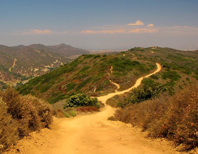
The trail continues climbing until you reach the West Ridge trail. Turn right, (north) and follow the undulating wide fire road along the ridge catching superb views on either side. After about ¾ of a mile make a right (east) turn at the Star Rise trail junction. The trail is pretty steep as it descends into Bell Canyon and is notorious for being washed out after heavy rains. Like the West Ridge trail, there isn’t much shade and on warm sunny days, so be sure to wear a hat and bring plenty of water.
In about ½ mile you’ll make a right (south) turn onto the Oak trail. This incredibly beautiful section of the hike brings you under the cooling shade of ancient, twisted oaks and expansive sycamores. Do yourself a favor and stop for a short rest under any of these beauties to take in how magnificent they are. If you brought a snack, enjoy it here. Experiencing such trees is one of the joys of the natural world so take some time to mentally record it all.
 Once you’ve emerged from this state of oneness with the oaks and you’ve picked up some of the trash left by less conscientious hikers, continue south towards the parking area, following any number of paths you’ll find as you leave the oak and sycamore forest. If you feel like taking in another mile or two, bear south to find the Pinhead Peak trail. It’s an up-and-back 1.5 mile walk to the summit of a 662’ elevation viewpoint that gives a nice panorama of coastal canyons, chaparral and alluvial plains. If you ignore the smattering of structures and roads seen in the distance, you might be able to glimpse what California looked like 100 years ago, especially if you squint a little.
Caspers offers many other hiking options, all of them having a particular charm or quality that makes them worth the sweat. But if you've never been before, when you visit the park don't miss this moderately easy loop hike. And hug an oak while you're there. They appreciate the love.
For more information:
OC Parks: Caspers
Caspers WP Brochure
Caspers Trail Map
Caspers Photo Set
Thursday, April 28, 2011
Community Wilderness Parks Rating: Caspers Wilderness Park
Not all community wilderness parks are created equal. All may afford city dwellers the opportunity to feel dirt beneath their heels and see a horizon filled with trees instead of cell towers but some do it better than others. Having visited a few, I pondered a way to rate the parks on some sort of sliding scale. I wanted a system that could be applied to just about any community wilderness park so I just made this one up...like just now. The perfect community wilderness park (CWP) scores a 10 on all factors on a “CWP Rating System™.” It's purely subjective, based on limited personal observation and subject to revision with each blog update.
Trails: Mixed use as well as single-track hiking-only trails of varying lengths and difficulty. Trails are well marked, maintained and actually lead to someplace interesting. Extra points for loops or connecting trails that allow for a 12+ mile hike.
Bonus Points: Easily obtainable trail maps, size of park, friendly volunteers, historical significance, special community events, portions of the park are wheelchair friendly, nicely paved roads, adequate parking and other things that make the visit pleasant.
It’s important to understand that this system is not really suited for large national parks or forests, backcountry destinations or other true “wilderness areas,” but those greenbelt areas that a community sets aside for residents and visitors to get a little outdoor time. Most of the parks have a certain family-friendly quotient, but all should afford even the solitary visitor the opportunity to escape for a few hours and to think of nothing more important than returning to a trailhead before total darkness sets in.
Let’s see how one of my favorite wilderness parks scores on the CWP Rating System. The first is Caspers Wilderness Park. I’ll feature it in a “favorite trail” review soon.
 Located just east of San Juan Capistrano, California, Caspers Wilderness Park is part of the Orange County park system and is considered by many visitors to be the best of its kind in the OC.
Ease of Access: 9
The park is easily reached via California Hwy 74, aka the Ortega Highway. Bicyclists are often seen on Hwy 74 though many do not venture too many miles east of the park due to the highway’s infamous notoriety for frequent motorcycle accidents.
Human Infrastructure and Facilities: 7
The park is equipped with a nice visitor’s center, flush toilets, camping spots, a ranger-staffed front gate, good parking and paved intra-park roadways but troubled with frequent running water stoppages for multiple reasons.
Trails: 8
Many trails intersect and run the length of the park providing hiking, biking and riding adventures for trail users of all ages and skill levels. Some trails include sections near the Ortega Highway which makes for a reduced outdoor experience.
Remote-ness: 7
Because of its location, it’s a simple matter to get away from highway sounds and sights. However, some of the views along the upper ridges unfortunately include small enclaves of expensive homes and ranches.
Natural Beauty: 8
Caspers scores pretty high here. The tortuous and ancient oaks, spreading sycamores, relatively abundant wild critters and sometimes interesting geology (i.e. white sandstone bluffs and alluvial plain feeder valleys) gives the park visitor healthy dose of true wildness. The park is bordered by a number of ridges providing a variety of natural settings such as soft meadows, rocky steam beds, darkly shaded canyons and bare ridgelines.
Bonus Points: 6
“Adventure Day” and a number of other activities occur at the park offering families a nice outdoor experience. The park has good facilities for horses, including pipe corrals and watering troughs. Parking is more than adequate and the volunteers here are helpful and friendly.
Total Subjective and Irrelevant CWP Rating System Score: 45 out of a maximum of 60.
Caspers is one of my favorite, nearby default wilderness areas. I fell in love with the place immediately and find myself returning many times a year.
Next time, I’ll review the West Ridge to Oak Trail Loop, a sweet trail that always pleases when visiting Caspers.
For more information please visit the sites below:
Caspers Information: OC Parks
Caspers WP Trail Map
Caspers WP Photo Set
The current CWP Rating System is comprised of six factors. Each factor is rated 1 to 10, 5 being average and 10 being highest. I tend to be a bit harsh in my ratings, so a “5” is not a bad score at all.
Ease of Access: The park is easy to find, can be reached without having to use granny low or a four-wheeled drive vehicle. Extra consideration is given for those accessible by bicycle.
Human Infrastructure and Facilities: Fresh running water, flush toilets, picnic benches, BBQ stoves, campgrounds, showers, trash and recycled waste receptacles, etc. Extra points for a visitor center and actual human staff or park rangers available.
“Remote-ness”: Can a visitor get far enough away from highway sounds and views of anything resembling community, i.e. housing developments, or other manmade structures that are not part of the park facilities? Extra points for parks in which this can happen relatively quickly.
Natural Beauty: Are the views, trees, geology, unique terrain, wildlife, meadows, ridge lines, canyons, streams, waterfalls, ponds and lakes, beaches or other natural features just beautiful? Extra points for natural aspects that are unique or special to the area.
Bonus Points: Easily obtainable trail maps, size of park, friendly volunteers, historical significance, special community events, portions of the park are wheelchair friendly, nicely paved roads, adequate parking and other things that make the visit pleasant.
It’s important to understand that this system is not really suited for large national parks or forests, backcountry destinations or other true “wilderness areas,” but those greenbelt areas that a community sets aside for residents and visitors to get a little outdoor time. Most of the parks have a certain family-friendly quotient, but all should afford even the solitary visitor the opportunity to escape for a few hours and to think of nothing more important than returning to a trailhead before total darkness sets in.
Let’s see how one of my favorite wilderness parks scores on the CWP Rating System. The first is Caspers Wilderness Park. I’ll feature it in a “favorite trail” review soon.
 Located just east of San Juan Capistrano, California, Caspers Wilderness Park is part of the Orange County park system and is considered by many visitors to be the best of its kind in the OC.
 Ease of Access: 9
The park is easily reached via California Hwy 74, aka the Ortega Highway. Bicyclists are often seen on Hwy 74 though many do not venture too many miles east of the park due to the highway’s infamous notoriety for frequent motorcycle accidents.
Human Infrastructure and Facilities: 7
The park is equipped with a nice visitor’s center, flush toilets, camping spots, a ranger-staffed front gate, good parking and paved intra-park roadways but troubled with frequent running water stoppages for multiple reasons.
Trails: 8
Many trails intersect and run the length of the park providing hiking, biking and riding adventures for trail users of all ages and skill levels. Some trails include sections near the Ortega Highway which makes for a reduced outdoor experience.
Remote-ness: 7
Because of its location, it’s a simple matter to get away from highway sounds and sights. However, some of the views along the upper ridges unfortunately include small enclaves of expensive homes and ranches.
Natural Beauty: 8
Caspers scores pretty high here. The tortuous and ancient oaks, spreading sycamores, relatively abundant wild critters and sometimes interesting geology (i.e. white sandstone bluffs and alluvial plain feeder valleys) gives the park visitor healthy dose of true wildness. The park is bordered by a number of ridges providing a variety of natural settings such as soft meadows, rocky steam beds, darkly shaded canyons and bare ridgelines.
Bonus Points: 6
“Adventure Day” and a number of other activities occur at the park offering families a nice outdoor experience. The park has good facilities for horses, including pipe corrals and watering troughs. Parking is more than adequate and the volunteers here are helpful and friendly.
Total Subjective and Irrelevant CWP Rating System Score: 45 out of a maximum of 60.
Caspers is one of my favorite, nearby default wilderness areas. I fell in love with the place immediately and find myself returning many times a year.
Next time, I’ll review the West Ridge to Oak Trail Loop, a sweet trail that always pleases when visiting Caspers.
For more information please visit the sites below:
Caspers Information: OC Parks
Caspers WP Trail Map
Caspers WP Photo Set
Tuesday, April 19, 2011
Best Day Hike in Daley Ranch: "The Whole Enchilada"
If the world was perfect and I could control the outcome of all things, I would have my own private Daley Ranch. It is for me a refuge where it is possible to replace the sound of highway traffic with bird song and the sound of my own breathing. It is a place where I can see an expanse of only wild things rather than Wal-Marts. Within its 3,000 plus acres I can walk and take in the soul healing power of a dirt path and open sky. It is a small sliver of wilderness within a short distance of a freeway offramp. It is heaven within reach.
 Located at northeast end of Escondido, California, Daley Ranch is a secluded valley that is an unique amalgam of rolling ridges, boulder decorated hills, ponds, wetlands, wildlife, massive oaks and view-worthy peaks. At one time, the land was owned by the Daley family who would use the property as a summer retreat and quasi-dairy operation. Though the land changed hands a few times, the City of Escondido wisely purchased the property, added a few additional acres to include Stanley Peak and dedicated it as a wilderness recreation park in 1997. Immediately adjacent to the park is Dixon Lake a small fishing lake with picnic areas and paddle boats. Though Daley does not charge for parking or admission there is a fee for entering the Dixon Lake area.
For a day-hike area, it’s really hard to beat if you live in the North San Diego or South Orange County areas. The hiking varies from relatively easy to moderately difficult as the network of over 20 miles of trails traverses across ridge lines and meanders through rare Engelmann oaks. In addition to the nice selection of short hikes available, I think it’s the oaks and boulders that appeal to me most. For being so close to home and major metropolitan areas, it’s a beautiful place to visit now and again.
 There are three recognized trailheads to the park, the primary one being near the Dixon Lake entrance off of La Honda. Free parking is available immediately in front of the Ranch’s main gate. Parking in the main lot is permitted until dusk. (NOTE: On weekends, a shuttle service offers rides to folks wanting to visit the main ranch house, barn and picnic area. Watch out for the bus and the mountain bikers sharing the main access road.) Two of the most popular hikes are the Boulder Loop; moderate 3.5 mi and what I call the Sage Loop; moderate 4.5. Each of those hikes will lead you back to the main gate.

By following the below list of trail names in order, you’ll get in just under 14 miles of good hiking and a peak to boot. Download the trail map located at the link below as a reference to this hike.
THE WHOLE ENCHILADA LOOP
 Water is only available at the La Honda parking area and during the summer, this rocky, inland valley can become quite warm so bring plenty. A pay phone and chemical toilets are available at the ranch house.
I'm not sure if I'd label the trails at Daley Ranch as "destination hikes," but you really shouldn't miss the place if you're within a hour's drive. Actually, heaven's worth even a two hour drive if you need a little slice.
Daley Ranch Trail Map
Daley Ranch Information
Daley Ranch Photo Set

For a day-hike area, it’s really hard to beat if you live in the North San Diego or South Orange County areas. The hiking varies from relatively easy to moderately difficult as the network of over 20 miles of trails traverses across ridge lines and meanders through rare Engelmann oaks. In addition to the nice selection of short hikes available, I think it’s the oaks and boulders that appeal to me most. For being so close to home and major metropolitan areas, it’s a beautiful place to visit now and again.


My hike of choice (when I have the time) encompasses the entire ranch area, providing a chance to see just about all of the terrain and beauty the place has to offer. You’re also likely to find some solitude once you hike to the outer edges of the park as few people tend to go north of the ranch house. I call this hike, “The Whole Enchilada Loop.”
By following the below list of trail names in order, you’ll get in just under 14 miles of good hiking and a peak to boot. Download the trail map located at the link below as a reference to this hike.
THE WHOLE ENCHILADA LOOP
- Creek Crossing (look for Dixon Lake to the south)
- East Ridge
- Sage (look for seasonal ponds in the area)
- Stanley Peak (nice views to the east)
- Sage (pass by Mallard Pond on your left)
- Ranch House (chemical toilets and picnic tables)
- Jack Creek Meadow (eastern loop portion)
- Hidden Springs (the steepest one-mile section in the park)
- Engelmann Oak (head north at the junction)
- Cougar Ridge (nice views to the west)
- Boulder Loop (favorite section of the hike)
- Ranch House (head south to the parking area)
If you find that daylight is rapidly vanishing or your endurance is lagging a bit, the hike itinerary can be easily be shortened to shave off a few miles by taking any number of shortcuts. One of the surprisingly nice shortcuts is via “Bobcat Trail” which bisects the Engelmann Oak Loop. On a very warm day a few summers ago, I began to run out of water so took this trail to shave off a mile. The Bobcat trail is a shaded, one track trail that was a nice change of pace from the hot sun that day.

I'm not sure if I'd label the trails at Daley Ranch as "destination hikes," but you really shouldn't miss the place if you're within a hour's drive. Actually, heaven's worth even a two hour drive if you need a little slice.
Daley Ranch Trail Map
Daley Ranch Information
Daley Ranch Photo Set
Subscribe to:
Posts (Atom)