Tuesday, May 15, 2012

Soldiers Pass - Brins Mesa Loop; Sedona Magic


~ 6 mile loop
800' Gain/Loss
Moderate Difficulty


Even for non-believers, Sedona is magical.  The supposed swirling energy vortexes that dot the area are truly no match for the sheer magic and beauty of the hematite (iron oxide) laden sandstone red rock (known as the Schnebly Hill Formation) framed by lighter bands of limestone. Once viewed, it is easy to see why these red rocks would easily inspire a spiritual response even to the most stoic, jaded visitor.

This inspiration is not isolated only to the artist, mystic or seeker of the sacred. For the hiker, Sedona is likely to create a sense of unabashed awe.  Guidebooks point to at least 150 trails, loops and cross-country treks with more being established every year. Though Sedona proper encompasses only 19 square miles of land, its trekable environs reach well beyond the city limits.

To deal with the overwhelming decision of what trail to tackle, there is no better place to stop than The Hike House. Located near the intersection of highways 89A and 179, their sage advice and “Sedona Trail Finder” computer program will help you find the right hike, practically customized for just for you.  They also have a nice gear and clothing store. Their snack shop is a good place to energize the body before or after a hike. Don’t miss this place.

For this trip, the Soldiers Pass – Brins Mesa – Cibola – Jordon Trail loop was selected. With a total mileage of about 6 miles and an elevation change of about 800 feet, this loop offers views, natural arches, sinkholes, sacred pools and a trek along a high mesa.
 
The trailhead is accessed by taking Soldiers Pass Road off of Hwy 89A, following it northerly through a subdivision until it intersects with Rim Shadows Road. Make a right and look carefully to the left as you drive on Rim Shadows for the small, but well established trailhead parking lot. 

Though others have stated otherwise, according to the Hike House and the most recent map I have, a Red Rocks Parking Pass (available at Ranger Stations and Hike House) is not required here as it is in many other trailhead parking lots. The lot can and often fills during peak hours and is locked after 6:00 pm. If you do find yourself behind the locked gate, it will automatically open when approached in a car.

Follow trail signs for the Soldiers Pass Trail as it parallels and crosses some wide jeep trails. Stay to the left of the Jordan Trail intersection as you step up to the Devils Kitchen, the only natural sinkhole in Sedona.  Continue on until you reach the Seven Sacred Pools, a series of naturally carved pools created by runoff from the surrounding terrain. 

The pools generally have some water in them year-round and wildlife frequent them in the early mornings and late afternoons.  This is where you will likely see the crowds thin out and won’t see any jeeps again until the end of the hike.  Red rock cliffs adorn on either side of the trail which makes it difficult to concentrate on the path before you.

A little more than a mile from the trailhead you may notice a side trail located just past a posted metal Forest Service Wilderness sign on your right. If you follow this well marked trail, (often blocked with stones and branches) you’ll be treated to a number of arches and alcoves on the side of the opposite mesa. The trail leads to a slick rock ledge and then sharply up just shy of one third of a mile to a series of three arches.

Returning again to the Soldiers Pass trail, you’ll soon begin to climb more steeply up a single track to the top of Soldiers Pass, topping out at about 2.2 miles from the trailhead.  I highly suggest that before you work your way up along a ridge to the top of Brins Mesa, stop and look behind to look down into Soldiers Creek Valley, the town of Sedona and Bell Rock in the distance.  At the Soldiers-Brins intersection, turn right towards the top of and across Brins Mesa.

The walk across the mesa is easy as you pass skeletons of large trees surrounded by abundant new growth oaks and cypress. This forest is rebounding wildly from a devastating fire in 2006.  To the north and east, you’ll be treated to views of Mormon Canyon, Schnebly Hill and Mitten Ridge. Soon the trail will lead to the edge of Brins Mesa and then drops sharply to a series of natural stone steps and a gravel strewn, slippery path into Mormon Canyon.  

Follow Brins Mesa Trail until you encounter a parking lot (the Brins Mesa/Jordon Trail trailhead) located about 2 miles from the Soldiers Pass intersection. Before reaching the lot, look right for the Cibola Pass trail and make the sharp right as it traverses towards Cibola Rock, an unusual formation that will eventual rise northeast of your position.

After almost a mile, keep an eye out for trail signs that leads to the Jordan Trail.  My trail map did not include some newly developed trails, Javelina and Ant Hill to name two, so be mindful that you don’t take an unplanned side trip.

The Jordon Trail continues about .7 miles further where it meets up with the Soldiers Pass Trail, just south of the Devils Kitchen. Turn left onto Soldiers Pass and follow it for about a half mile to your starting point trailhead parking lot.

The hike is a moderate one with a few steep climbs, jaw-dropping views and satisfying day hike mileage.  A quick Google search will give you numerous sites that also outline this hike, but I recommend a visit to David Creech’s hiking blog, featured below, as well as a stop to the Hike House for additional maps and friendly guidance.

Any visit to Sedona will undoubtedly result in the desire to return, explore further and discover so very much more. Perhaps you might also find a missing piece of yourself that you never knew was gone.  Sedona is like that.  


Tuesday, January 17, 2012

Deer Springs to Suicide Rock Trail Report: Memories Renewed

~7 miles RT
Moderate Difficulty
1850 Elevation gain/loss

There are views, trees and trails that exist in a hiker's memory forever. It is difficult to describe to someone who may not frequent the outdoors or backcountry, but for many who seek out dirt paths and open skies, these places and things have a special hold on us. Not unlike a special song that resides in the soundtrack of a person's life, it is possible for a hiker to recall with extreme clarity when, where and with who he or she was with on a particular trek.  All it takes is a particular vista or bird song or vanilla-scent pine bark or the taste of dust on your tongue or the weight of a pack to bring all of it into focus.


For me, those moments are deeply rooted in the San Jacinto mountains. Located due west of Palm Springs, it was in those mountains and on those switchbacks where I learned a great deal about the wilderness, and about myself. For me, these rugged peaks are personal touchstones for so much of my life.


John Muir called the San Jacintos Southern California's own "range of light" since they are very similar in geology, climate, appearance and altitude to the Sierras. In fact the same forces that created it's northern cousins are responsible for the San Jacinto wilderness area.


My first excursion into this area was at age 13 climbing the Devil's Slide Trail to Skunk Cabbage Meadow. A relatively short hike but as anyone who's hiked the Devil's Slide, the 2.5 mile climb from Humber Park to the Saddle is notoriously steep for a beginning hiker and due to its popularity, a bit over-loved.

Other than the Palm Springs Tram, it is generally accepted as the most popular and fastest way to the higher elevations and hanging valleys that rest between San Jacinto and Tahquitz peaks. I've lost count on how many times I've been on that trail, but suffice to say it became as familiar as an old boot and eventually, about as exciting.


It certainly isn't the only way up, and though at one time I could easily boast that I had hiked every trail in the system in the area, there was one exception, the Deer Springs trail. That is no longer the case and I truly regret for not correcting that experience gap many years ago. Deer Springs is a sweetheart of a trail and highly recommended for anyone visiting and hiking the Idyllwild area.

From Deer Springs, one has access to the entirety of what these mountains have to offer, including San Jacinto peak, Round Valley and and all the rest without having to deal with an overly crowded parking area, heart breaking hiker limits or endless switchbacks that is the hallmark of Devil's Slide. For sure, it takes a few more steps to gain altitude, but the more moderate elevation gain allows a hiker to perhaps enjoy the scenery a bit more.

Last October was my first time on the trail with an inaugural trek to Suicide Rock. It occurred to me that the last time I had even visited Suicide Rock was via a face climb. But that was 35 years and 35 pounds ago. I prefer walking sticks to carabiners these days.  Accessing the top of Suicide Rock via this route was just as satisfying as the face climb done so long ago.


The trailhead is located directly across the street from the San Jacinto Nature Center, about a mile north of the small mountain community of Idyllwild. A turnout serves as the parking area with the trail leading quickly away from the adjacent highway noise. Follow the wide and well marked trail for about .5 miles after which you'll enter the San Jacinto Wilderness. You'll need a wilderness permit to enter the area from that point on. Unlike the Devil's Slide trail, you'll have no problem getting a permit for this trailhead at the ranger's station in Idyllwild the day before or even the morning of your hike.  The only restriction is that your group is no larger than 12 hikers per permit.


The trail is a steady but manageable climb from 5,600 feet to an eventual 7,450 elevation on top of Suicide Rock. Oaks and Mazanita will give way to magnificent Incense Cedar and Maidenhair Ferns as you near the Suicide Rock Junction 2.25 miles from the starting point.

Follow the signs to Suicide Rock another 1.25 miles on. A left turn at the junction leads to San Jacinto peak, but I'll leave that destination for another day.


Many of the trail guides you'll read will tell you that after the steady climb to the junction, the trail flattens and the mileage is right at or just below a mile to the Rock. Don't believe it. The trail continues to climb, albeit rolling but steep in parts, for the longest mile in hiking history. In other words, if you think the hard part of the hike is over when you reach the junction, it's not. Expect more of the same that you've already hiked to this point and you won't be too surprised or discouraged with the remaining section of trail.


The views from Suicide are spectacular. It affords a clear view of Tahquitz Rock, the town of Idyllwild and miles of flatland laying westerly towards the ocean. There are plenty of places on bare, flat rock, exposed to the sky, perfectly suited for gazing heavenly or spreading out a lunch. It's advised to be on the lookout for rattlers nesting in wide cracks on top of the bald, however. On the day we visited, a total of 6 of the snakes were spied, two of them coiled together and as large as a fire hose. They were content to let us visitors to have our time taking all of it in before returning the way you came for a nearly 7 mile round trip hike in Southern California's own alpine ruggedness.


The Deer Springs Trail is highly recommended as a convenient and lovely access to the wonderful peaks and valleys above Idyllwild. Don't pass it up just because it may add a mile or two to your destination. The extra trail time is well worth it.

Amazingly detailed plant guide following the entire trail: Deer Springs Plant Guide


Park Guide and Permit Information: San Jacinto State Park Guide

Sunday, August 14, 2011

Aliso and Wood Canyons: A hike in 3 acts

"Aliso and Wood Canyons Loop"
11 Mile loop hike
900' Elevation gain/loss
Moderately Strenuous

The OC Park system should be mighty proud because they are mighty clever. No doubt by design, many of the system’s wilderness areas are truly citadels of open and very wild spaces bumping up to the backyards of expansive and expensive housing developments. The Aliso and Wood Canyons Wilderness Park is no exception and may indeed be the prototype for such planning.

The park with its rambling name is almost 4,000 acres of former Spanish land grant ranchos hosting rolling hills, flat meadows and lush canyons and is positioned within long-walking distance from the Pacific Ocean as it overlooks the town city of Laguna Beach. What also distinguishes this park from many of its local cousins is its offer of a hike longer than just a few miles.  But like any in the park, the first and third acts of these hikes are at best, a dull production. However the long second act more than makes up for that blandness.

Begin your hike at the parking lot of the Visitor Center that is worth a quick peek.  Be sure to check out the fossils found in the sandstone and limestone formations that exist in the park. There’s a $3.00 parking fee, payable with a credit card. Portable toilets with hand washing facilities are adjacent to the lot. There may be running water for drinking somewhere, but I didn’t see any.

Just past the Center is the paved trailhead leading to the mouth of Aliso Canyon along Aliso Creek Trail.  The paved road is actually an access for the Also Water Management Agency and as such is a private road. Its open all weekend but reportedly there have been times when its closed during the week because of work being done on the parallel running creek. This portion, or first act, of the hike is unremarkable. Families with strollers or children on bicycles will find the wide, flat road useful and pleasant to enjoy but for the hiker or mountain biker, its just whatcha gotta do to get to the good stuff.

The good stuff lies just 1.5 miles beyond the parking lot trailhead at the clearly marked trailhead for Wood Canyon Trail.  I know of some hikers who will ride their bikes to this junction and lock them up on the handy bike rack located there.  Portable toilets are also located here, but again, no running water.

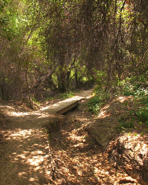
Follow Wood Canyon north for about .75 miles to the Dripping Cave junction which will be on your left and clearly marked like all of the trails at the park. It’s a short jaunt to the cave that you’ll find just beyond a wooden footbridge. 

SIDE TRAIL: Before reaching Dripping Cave, you’ll see signs leading to Cave Rock, a substantial limestone formation eroded by wind and water to form several small caves. You’ll be able to see the rock if you stay on the main trail so there’s no real need to take the side trail unless you really want to.

After reading about how the cave was the supposed hideout of 19th century bandits, return towards the footbridge but instead of crossing it, veer to the left (north) trail that leads toward Mathis Canyon.  The trail becomes a bit steep for about 150 yards before it drops down again into a lovely meadow residing in the bottom of Mathis Canyon.  Before reaching the meadow, you’ll see even more caves as you walk beneath a cool oak canopy.  After crossing the eastern edge of this canyon meadow, you’ll intersect with Mathis Canyon Trail.  This is the last shade you’ll have for a while and the hike becomes much more challenging. 

SIDE TRAIL: Before the climb, note the side trail to Oak Grove. Though overlooked by most, the grove resides in a narrow ravine that offers a bit of solitude from the rest of the folks on the trails. Deep and shady, I consider this a destination for a shorter, up-and-back 6-mile hike.  The adjacent rock formations also make it particularly worthwhile.

Mathis Canyon Trail provides a 550’ elevation gain in approximately 1.25 miles. It’s steep with few level, catch-your-breath sections until near the very end of the climb to the West Ridge Trail. At the junction of Mathis and West Ridge, turn right (north) on the wide fire road trail. Expect lots of other folks to also be there, many of whom started at the Alta Laguna Park in Laguna Beach.

The undulating ridge is a welcome walk after the climb to reach it. The views and breezes up there contain elements of the nearby ocean making it very pleasant.  Continue north on the ridge past the cell phone towers and water tank until you reach the Lynx trail on your right.  Take a moment to sit on the convenient rock at this junction to retie your shoes before making the descent back into Wood Canyon.  You’re about at the halfway mark of the 11 miles at this point. Parts of this downhill, single-track trail are steep and slick. Since you may also encounter bicyclists on this trail, be extra cautious.

At the bottom, you’ll intersect with Wood Canyon Trail and a right turn will bring you back to your starting point. If you brought a snack or a lunch, I’d find a shady spot here. There’s no more climbing to do, a sweet stream whispers nearby and there's lots of shade from the giant, spreading oaks found in the canyon. The entire scene makes for a nice place to regroup your thoughts, cool off from the exposed ridge and loosen up those boots if you like.

SIDE TRAIL: Hiking-only trails (Wood Creek Trail and Coyote Run Trail) parallel the main, shared use Wood Canyon trail. Signs show how to access them from Wood Canyon.  The upside of using these trails is that you won’t be dodging bikers but the downside is that you may find the creek a bit further away at times and perhaps a little less shade is offered, especially on Coyote Run.

Follow the Wood Canyon Trail southeast back towards Aliso Canyon and eventually the parking lot from where you started. The trail follows along Wood Creek that was still flowing with an impressive amount of water in August. You’ll cross the stream three times before once again reaching the Dripping Cave trail junction.  From there, your hike enters its third and final act as you rejoin the paved water management access road.  It’s during this last 1.5 miles that I’ll plug in my Nano and unwind as I listen to some nice music and soften my pace before reaching my car to drive home.


A tip of my Tilley hat once again to the OC Parks system.  Aliso and Wood Canyons Wilderness Park did what it was designed to do; provide me with an open sky and miles to hike beneath it without having to travel far to reach it all.


Helpful Links: