Thursday, December 30, 2010

Favorite Hikes and Outdoor Destinations: 2010

This last year provided many opportunities for walking on dirt under open skies. In addition to the list below, there were a few neighborhood open space park hikes that were quite nice, but certainly this list is of the best hikes taken in 2010. The list is alphabetical as it would be difficult to rank them by preference as each had something special to offer.

· Blue Ridge Parkway; Graveyard Fields Trail, North Carolina

· Bryce Canyon National Park; Queen’s Garden Loop, Utah

· San Juan Capistrano- Caspers Wilderness Park; Oak Canyon Loop, California

· Chino Hills State Park; Skully Ridge to Lower Aliso Trail, California

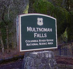
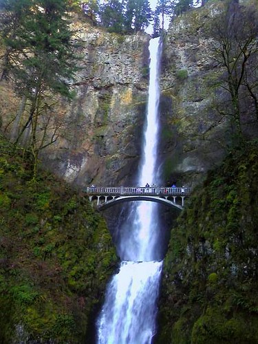
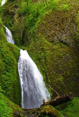
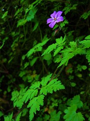
· Columbia River Gorge; Gorge Trail Loop, Oregon

· Crater Lake, Oregon

· Daley Ranch; Circumvent Loop, Boulder Loop (and others), California

· Dry Tortugas National Park; Fort Jefferson Walkabout, Florida

· Humbolt Redwoods; Boy Scout Loop Trail, California

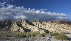
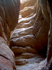
· Indio- Mecca Hills; Split Rock and Ladder Canyon Trails, California

· Joshua Tree National Park; Hidden Valley, Barker Dam and Lost Palms Oasis Trails, California

· Laguna Coast Wilderness; Laurel Canyon Loop, California

· Prescott- Granite Dells; Peavine Trail, Arizona

· San Diego- Mission Trails; Oak Creek/Grasslands Loop and Cowles Peak Trails, California

· San Luis Obispo; Johnson Ranch Loop, Cerro Cabrillo Peak and Bishop Peak Trails, California

· Sequoia National Park; Tokopah Falls and Weaver Lake Trails, California

· Zion National Park; Kolob Canyon-Middle Fork Taylor Creek Trail, Utah

· Zion National Park; Narrows and Observation Point Trails, Utah


Looking forward to 2011 and those trails yet to tread as well as much loved favorites.

Thursday, May 27, 2010

Multnomah-Wahkenah Falls Loop

Multnomah-Wahkenah Falls Loop
Columbia River Gorge, Oregon
6.3 miles - 1,600 elevation gain
Moderately Difficult

Multnomah Falls is arguably the second most recognizable feature of the Columbia River Gorge. The first is the river itself. This iconic spectacle is a popular tourist destination due to its beauty and comfortable tourist accommodations including a sit down restaurant, fully loaded gift shop, paved walkways and flush toilets. Highway access is quick and easy. There could be no better place for locals to bring visitors to Portland when wanting to truly impress them with the area’s natural beauty.

Most folks will take the ½ mile walk to the base of the first fall to peer upward from the circa 1914 concrete constructed Benson Footbridge. A number of others may even venture a bit more to peer dizzyingly over the upper fall’s cascade though it can produce some gasping breaths from those unaccustomed to steep walking. Even fewer take the opportunity to see some of the other wonderful falls higher up the gorge’s talus slopes and into the thick rainforest, which is exactly what I wanted to do during a recent trip to Portland to visit family and friends.

Depending on who you ask and which trail map you pick up, the Multnomah-Wahkenah Falls Loop hike is known either as Loop #1 or Loop #2. This map shows the route as Loop #2. Many of the hiking guides tell you to trek this in a clock-wise manner, from Multnomah Falls towards Weisendanger Falls but I would advise you to take this route in the opposite direction. Due to the crowds on the Multnomah Falls walkway (I’m hesitant to call this section a "trail," since it’s nicely paved, wide and well engineered. I spied many folks walking in flip-flops along the steep grade) I recommend saving this human traffic jam to the end of the hike. It would be a shame and misleading to allow this to set the tone for the remainder of the trek.

The hike is well documented on other sites including; Oregon.com Multnomah Falls Guide and Tripcart.com Multnomah Falls Guide
which give varying accounts of mileage and difficulty. In rechecking my calculations, the hike with side steps to lookouts and such is right at 6 miles with an elevation gain of approximately 1,600’.

Begin and end the hike at the Multnomah Falls Lodge. From the falls proceed west, past the lodge and parking area as you parallel the Historic Columbia River Highway until you reach Wahkenah Falls. Begin your climb up the gorge’s south wall as you travel a good distance along Wahkenah Canyon creek. The canyon fills your ears with the music of the rushing creek, as moss draped pines and deep green ferns saturate your eyes. I honestly don’t think I’ve ever hiked in a more beautiful forest setting.

The climb up-canyon continues for about 2.7 miles until it levels off on the southern slope of the gorge. Along the way you’ll discover Fairy Falls, a lovely fan waterfall that invites many photos to be taken. Near the high point of the hike, you’ll have opportunities to visit Devils Rest, another 1.6 miles and Larch Mountain, an additional 5 miles from the trail junction.

When you begin to descend north along Multnomah Creek, several more small waterfalls are found including Wiesendanger and Ecola falls. Though the scenery remains spectacular, it is along this section of trail that you’re likely to encounter more hikers who’ve come up from Multnomah Falls, the number of which will increase to distraction and irritation until you reach the main lodge again.

I’m definitely repeating this hike on subsequent visits to the area but will also strive to summit Larch Mountain next time. From the photos and trail guides I’ve read, it should prove to be a rewarding experience. The top of the mountain is similar to a bald; unprotected by trees thereby offering unobstructed views for miles in all directions.

In addition to the other charms of the area, both in terms of the inhabitants and environs, this hike will be just one more reason to return. And soon.

Tuesday, April 27, 2010

Johnson Ranch: San Luis Obispo

Johnson Ranch is the newest addition to San Luis Obispo's open space park inventory. It's not a large park, the main trail only offering about 4 miles of easy going, single track hiking, but it is a beautiful park, maybe even strikingly so at certain times of the year.

I was fortunate enough to happen upon it on a recent business trip to the San Luis Obispo area. Heading towards a more familiar trail at the end of the day, I spied the parking lot and trailhead from the highway as I was nearing my hotel. After a quick U-turn, I found a handful of friendly local hikers and moutain bikers who were making the best of the fading light and expansive green hillsides decorated with a narrow brown ribbon of trail threaded along the undulating glades.

The new park has gained more than a few online fans who speak of the history of the ranch and its environs. In the spring, the park's hills can be verdant, lush. During the summer months, the dry grasses give the landscape a soft, satisfying and warm glow, accented with deep green oaks offering welcome shade.

The trail is supplemented with a number of wooden bridges that help you to navigate across ravines and a year round stream, the habitat of a small number of steelhead trout. As such, a good portion of the park, while open to view and enjoy from a distance, is so sensitive that hikers are not allowed.

Unfortunately, a growing number of feral pigs haven't been told of the sensitive nature of the area and have made themselves a bit of a nuisance. In addition to tearing up some countryside, they've been stirring up sediments in the stream making life for the rare steelheads a bit tougher. Some hikers have reported confronting the pigs, but no injuries have resulted from the encounters.

Johnson Ranch is certainly not a destination hike, but if you find yourself in the San Luis Obispo area for any reason, do take some time to check this place out. There is a remarkable, sprawling oak tree that spreads up, back into the ground and then out again that makes the trip worth it. The trail travels beneath this wonderful tree, so you can't miss it.

The link below will lead you SLO's Park and Recreation website. Other Open Space Parks are listed, including the Irish Hills Natural Reserve, which has some very sweet trails that I will describe later.

SLO Open Space Parks

Wednesday, February 24, 2010

Mecca Hills: Utah Lite

Ladder Canyon
There are hikes you take for no other reason than they're fun. Not necessarily challenging, no peak-bagging, but just plain fun. The slot commonly called "Ladder Canyon" in the Mecca Hills south east of Indio, CA is exactly one of those hikes. When walked as part of a loop through Painted Canyon, the hike is about 5 miles, moderate in difficulty and worth the trouble to find it.

If you live in Southern California or find yourself in or around Palm Springs in the cooler months, you MUST do this hike.

From the parking area (direction in the links at the end of this post) you walk among high sedimentary rock walls that echo the sound of your footsteps in the trail's soft sand. After about a quarter mile, the canyon makes a wide right turn. To your left you'll notice a jumble of boulders, the result of a long ago cave-in at the mouth of a narrow slot canyon. Rock cairns and stones creating a large arrow in the sand, pointing the way may also be present to help guide you.

The boulders that create the cave-in are easily scrambled and you'll find your first of several ladders positioned by like-minded hikers to lead you to the bottom of the slot canyon. If you can do this ladder, you can handle the rest that lead you to the views from the upper ridge lines atop the canyon. The trail is well marked and once again cairns and stone arrows help to keep you on track.

After following the ridge in a mostly northerly direction, you'll head down into Painted Canyon back towards the trailhead. Painted Canyon is also noteworthy for the many incredible geological displays at each turn. You'll have a couple more ladders to negotiate down before the hike is completed and I predict you'll be tempted to do the entire thing all over again as you pass the caved-in entrance to the slot canyon on the way back to your car.

The below linked description says that it's a difficult hike. If you're in relatively good health, it's not. If you are a bit leery of heights or climbing wobbly ladders, you may not want to try this but I can't recommend the hike highly enough. Palm Springs Guide: Mecca Hills

The Mecca Hills area is one of those California gems offering landscapes unlike any other I know of, with the possible exception of portions of southern Utah. Certainly smaller in scale, it can serve as a proud runner-up to the canyons and hoodoos of Utah. Think of the Mecca Hills as "Utah-Lite," and if you're fortunate enough to live in southern California, just a few miles off Interstate 10. I recently spent a weekend there with some hiking friends, concentrating our exploring to the Painted Canyon area. Though we saw much, we barely experienced an introduction to this must-return-to-soon destination.

For more information on the area, be sure to pick up "140 Great Hikes Near Palm Springs," which lists many other trails in and around the area. It's available from Amazon for about $15. 140 Great Hikes

Like most deserts, there is no water to be found nearby so be sure to pack in plenty. The only other tip I'd pass on is that you might want to wear some gloves to help protect your hands on the rough canyon walls and boulders. And if you use trekking poles, you may want to have a way to attach them to your pack when not in use. You'll need both hands to mount, dismount and use the ladders safely.

I've posted a photo album of the area on my flickr pages:  Mecca Hills Photo Album

Favorite Hikes in Joshua Tree NP

Joshua Tree National Park is a most unique place and a special one in my history with the outdoors. I originally visited the park as a young Boy Scout when it was still a national monument. The massive boulders and other world qualities of the landscape gave rise to many wild imaginings and simple adventures.

As a young adult, I returned to climb monstrous boulders as I learned and then taught the basics of rock climbing. I would return many times to climb the rocks there, hone my skills and test my nerves. It would be the last place I would climb as well. February 18, 1989 was the last real climb I went on. I remembered it began to snow on a 3 pitch climb and my climbing partner and I had to rappel off the face to safety.

As an adult, I have returned to walk about the canyons, washes and ridges. Each visit brings new discoveries and new found appreciation for this most unique place. If you haven't been, you must see this place with your own eyes. It's a bucket list destination.

My current favorite hikes in the park are, in general order of preference:

Lost Palms Oasis: A 7.4 mile up-and-back that begins at Cottonwood Springs. For the first 3.2 miles, it is a moderate hike but increases in difficulty for the last .5 as you approach a deep canyon bearing a surprising number of California Palms. You can add an additional 1.5 miles by taking the Mastodon Peak loop, which intersects with this trail.

This hike provides a wide variety of terrains, views and fauna. The only thing it does not give you are Joshua Trees. PROTRAILS: Lost Palm Oasis


Lost Horse Mine: You can do this hike as an up-and-back to make it a 4 mile hike or do it as a loop for 6.2 miles. It’s a moderately strenuous hike that gives you some great views of the park as you climb, as well as a great visit to an old gold and silver mine, complete with tipple and mill ruins. NPS Map


Pine City: A 3.5 mile up-and-back hike to the only pine trees in the park. A moderate hike that has options to make it much longer. The trail leads to a collection of giant boulders shaded by California Juniper and Pinon Pine trees. A wonderful place for lunch as you sit beneath the shade of the trees and boulders. The “city” was apparently a small collection of wooden cabins inhabited by miners who worked the nearby Lucky Boy Mine. LOCALHIKES: Pine City


Barker Dam / Petroglyphs Loop: An easy hike of maybe 1.5 miles. It is my favorite to take as the last hike of the day. The setting sun casting a warm glow on the rock faces. You are more likely to see a few critters visit during this time as well. The trail takes you to the small lake created by a dam built to hold water for cattle then into a boulder lined valley. There is a small side track to the “Movie Petroglyphs” named so because a movie crew enhanced ancient petroglyphs with some paint to make the filming of them easier. MODERNHIKER: Barker Dam Loop


Hidden Valley Nature Trail: This easy hike is only 1 mile but is a complete delight. This small valley is home to an abundance of life. Do not pass it up. PROTRAILS: Hidden Valley Loop