Showing posts with label favorite hikes. Show all posts

Tuesday, April 19, 2011

Best Day Hike in Daley Ranch: "The Whole Enchilada"

If the world was perfect and I could control the outcome of all things, I would have my own private Daley Ranch. It is for me a refuge where it is possible to replace the sound of highway traffic with bird song and the sound of my own breathing. It is a place where I can see an expanse of only wild things rather than Wal-Marts. Within its 3,000 plus acres I can walk and take in the soul healing power of a dirt path and open sky. It is a small sliver of wilderness within a short distance of a freeway offramp. It is heaven within reach.

Located at northeast end of Escondido, California, Daley Ranch is a secluded valley that is an unique amalgam of rolling ridges, boulder decorated hills, ponds, wetlands, wildlife, massive oaks and view-worthy peaks. At one time, the land was owned by the Daley family who would use the property as a summer retreat and quasi-dairy operation. Though the land changed hands a few times, the City of Escondido wisely purchased the property, added a few additional acres to include Stanley Peak and dedicated it as a wilderness recreation park in 1997. Immediately adjacent to the park is Dixon Lake a small fishing lake with picnic areas and paddle boats. Though Daley does not charge for parking or admission there is a fee for entering the Dixon Lake area.

For a day-hike area, it’s really hard to beat if you live in the North San Diego or South Orange County areas. The hiking varies from relatively easy to moderately difficult as the network of over 20 miles of trails traverses across ridge lines and meanders through rare Engelmann oaks. In addition to the nice selection of short hikes available, I think it’s the oaks and boulders that appeal to me most. For being so close to home and major metropolitan areas, it’s a beautiful place to visit now and again.

There are three recognized trailheads to the park, the primary one being near the Dixon Lake entrance off of La Honda. Free parking is available immediately in front of the Ranch’s main gate. Parking in the main lot is permitted until dusk. (NOTE: On weekends, a shuttle service offers rides to folks wanting to visit the main ranch house, barn and picnic area. Watch out for the bus and the mountain bikers sharing the main access road.) Two of the most popular hikes are the Boulder Loop; moderate 3.5 mi and what I call the Sage Loop; moderate 4.5. Each of those hikes will lead you back to the main gate.

My hike of choice (when I have the time) encompasses the entire ranch area, providing a chance to see just about all of the terrain and beauty the place has to offer. You’re also likely to find some solitude once you hike to the outer edges of the park as few people tend to go north of the ranch house. I call this hike, “The Whole Enchilada Loop.”

By following the below list of trail names in order, you’ll get in just under 14 miles of good hiking and a peak to boot. Download the trail map located at the link below as a reference to this hike.

THE WHOLE ENCHILADA LOOP
  • Creek Crossing (look for Dixon Lake to the south)
  • East Ridge
  • Sage (look for seasonal ponds in the area)
  • Stanley Peak (nice views to the east)
  • Sage (pass by Mallard Pond on your left)
  • Ranch House (chemical toilets and picnic tables)
  • Jack Creek Meadow (eastern loop portion)
  • Hidden Springs (the steepest one-mile section in the park)
  • Engelmann Oak (head north at the junction)
  • Cougar Ridge (nice views to the west)
  • Boulder Loop (favorite section of the hike)
  • Ranch House (head south to the parking area)

If you find that daylight is rapidly vanishing or your endurance is lagging a bit, the hike itinerary can be easily be shortened to shave off a few miles by taking any number of shortcuts. One of the surprisingly nice shortcuts is via “Bobcat Trail” which bisects the Engelmann Oak Loop. On a very warm day a few summers ago, I began to run out of water so took this trail to shave off a mile. The Bobcat trail is a shaded, one track trail that was a nice change of pace from the hot sun that day.

Water is only available at the La Honda parking area and during the summer, this rocky, inland valley can become quite warm so bring plenty. A pay phone and chemical toilets are available at the ranch house.

I'm not sure if I'd label the trails at Daley Ranch as "destination hikes," but you really shouldn't miss the place if you're within a hour's drive. Actually, heaven's worth even a two hour drive if you need a little slice.

Daley Ranch Trail Map

Daley Ranch Information

Daley Ranch Photo Set


Monday, February 21, 2011

Rock and Awe; Best day hike in Joshua Tree NP

My first visit to Joshua Tree National Park was when it was still designated as a National Monument, nearly 45 years ago. Then and even now, I considered it a truly alien landscape as my eyes and imagination tried to take it all in; the massive boulders, expansive cliffs and the tentacled trees for which the park is named seemed to be from another place, far removed from the mere two-hour drive from home. But it is a very real place, deserving of its National Park status as unique and worthy of preserving for many more generations.

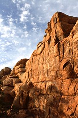
Hiking opportunities are numerous and include wide groves of Joshua trees, mysterious hidden canyons, desert washes, grottos and high ridges. Rock climbing is very popular here due to the impressive boulders and inselberg rock formations, most of which are comprised of quartz monzonite, a very rough, large crystalline form of granite.  Camping is primative, that is to say, no flush toilets, electricity or waste hook ups.  That does not discourage the many who visit and stay. It is not uncommon to find all sites filled to capacity during spring bloom weekends.  But I come for the hiking now. My climbing days are 35 years and 35 pounds ago. Because the trails here are so rewarding, I rarely miss scaling the rocks here.

After reading a few reviews of what was described as “The Best Day Hike” in the park, it was decided that this trail would be perfect for the next trip to the park. The reviews of this loop hike are right on target, even if the mileage estimates vary from 6.2 – 7 miles, as this has become my new favorite hike in the high desert.  When inquiring about this hike, it's best just to call it "North View-Maze-Window Rock" after the three trail segments that make up this particular loop.

The hike has been known of for quite some time, but until recently it required some orienteering skills to complete. The entire hike with it’s various loops and trail junctions are now well marked and signed. Anyone with moderate hiking experience will be able to finish the hike according to the prescribed route. However at times, the trail becomes “subtle” as it crosses over barren rocks and through washes susceptible to the smoothing out of boot tracks and cairn scattering. If you pay attention, carry a trail guide with a simple map you’ll be fine. If you wander off trail to take advantage of a photo op or to water the plants, be mindful of where the trail is at behind you. In some sections, the trail is virtually invisible unless you were directly on it.

Finding the trailhead is a little tricky as it is not well marked. The 3-4 car maximum parking area (called by some the “borrow pit” lot because of a nearby old gravel pit) is located immediately north of roadway marker 24 near the park’s west entrance.

This loop hike takes advantage of three trails, North View trail, Maze loop and Window Rock loop. Each trail section provides it own character which makes this hike compelling and anything but boring. The North View trail offers spectacular views of the village of Joshua Tree, Twentynine Palms and Copper Mountain. The views are framed with stacked boulder fins and naturally formed cairns.

The Maze loop leads you through low slot canyons, again built from stacked boulders, accented with cactus and juniper. The Window Rock loop presents a visual oddity in the form of a high rock window that at times will appear to be a large winged bird or just a square-like opening near a ridge line depending on your angle of view. Bighorn Sheep are readily spotted on this trail which also takes you through spreading groves of Joshua trees.

In short, it’s all here. Just about all of the visual, wildlife and floral attractions of the park can be found within this moderate difficultly loop hike. I can’t recommend it highly enough. This is the kind of hike that defines why I love to walk under open skies on paths unpaved.


A few guidebooks, “Afoot and Afield in the Inland Empire” by David and Jennifer Harris and “On Foot in Joshua Tree National Park” by Patty Furbush, describe the hike in more detail. Because the hike is still not high on everyone’s trail radar list, online resources are not abundant, but I did find these two nice references;

"Afoot and Afield" Book Excerpt

Trimble Outdoors Trail Guide

Wednesday, February 24, 2010

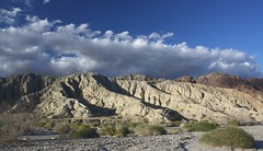
Mecca Hills: Utah Lite

Ladder Canyon
There are hikes you take for no other reason than they're fun. Not necessarily challenging, no peak-bagging, but just plain fun. The slot commonly called "Ladder Canyon" in the Mecca Hills south east of Indio, CA is exactly one of those hikes. When walked as part of a loop through Painted Canyon, the hike is about 5 miles, moderate in difficulty and worth the trouble to find it.

If you live in Southern California or find yourself in or around Palm Springs in the cooler months, you MUST do this hike.

From the parking area (direction in the links at the end of this post) you walk among high sedimentary rock walls that echo the sound of your footsteps in the trail's soft sand. After about a quarter mile, the canyon makes a wide right turn. To your left you'll notice a jumble of boulders, the result of a long ago cave-in at the mouth of a narrow slot canyon. Rock cairns and stones creating a large arrow in the sand, pointing the way may also be present to help guide you.

The boulders that create the cave-in are easily scrambled and you'll find your first of several ladders positioned by like-minded hikers to lead you to the bottom of the slot canyon. If you can do this ladder, you can handle the rest that lead you to the views from the upper ridge lines atop the canyon. The trail is well marked and once again cairns and stone arrows help to keep you on track.

After following the ridge in a mostly northerly direction, you'll head down into Painted Canyon back towards the trailhead. Painted Canyon is also noteworthy for the many incredible geological displays at each turn. You'll have a couple more ladders to negotiate down before the hike is completed and I predict you'll be tempted to do the entire thing all over again as you pass the caved-in entrance to the slot canyon on the way back to your car.

The below linked description says that it's a difficult hike. If you're in relatively good health, it's not. If you are a bit leery of heights or climbing wobbly ladders, you may not want to try this but I can't recommend the hike highly enough. Palm Springs Guide: Mecca Hills

The Mecca Hills area is one of those California gems offering landscapes unlike any other I know of, with the possible exception of portions of southern Utah. Certainly smaller in scale, it can serve as a proud runner-up to the canyons and hoodoos of Utah. Think of the Mecca Hills as "Utah-Lite," and if you're fortunate enough to live in southern California, just a few miles off Interstate 10. I recently spent a weekend there with some hiking friends, concentrating our exploring to the Painted Canyon area. Though we saw much, we barely experienced an introduction to this must-return-to-soon destination.

For more information on the area, be sure to pick up "140 Great Hikes Near Palm Springs," which lists many other trails in and around the area. It's available from Amazon for about $15. 140 Great Hikes

Like most deserts, there is no water to be found nearby so be sure to pack in plenty. The only other tip I'd pass on is that you might want to wear some gloves to help protect your hands on the rough canyon walls and boulders. And if you use trekking poles, you may want to have a way to attach them to your pack when not in use. You'll need both hands to mount, dismount and use the ladders safely.

I've posted a photo album of the area on my flickr pages:  Mecca Hills Photo Album

Favorite Hikes in Joshua Tree NP

Joshua Tree National Park is a most unique place and a special one in my history with the outdoors. I originally visited the park as a young Boy Scout when it was still a national monument. The massive boulders and other world qualities of the landscape gave rise to many wild imaginings and simple adventures.

As a young adult, I returned to climb monstrous boulders as I learned and then taught the basics of rock climbing. I would return many times to climb the rocks there, hone my skills and test my nerves. It would be the last place I would climb as well. February 18, 1989 was the last real climb I went on. I remembered it began to snow on a 3 pitch climb and my climbing partner and I had to rappel off the face to safety.

As an adult, I have returned to walk about the canyons, washes and ridges. Each visit brings new discoveries and new found appreciation for this most unique place. If you haven't been, you must see this place with your own eyes. It's a bucket list destination.

My current favorite hikes in the park are, in general order of preference:

Lost Palms Oasis: A 7.4 mile up-and-back that begins at Cottonwood Springs. For the first 3.2 miles, it is a moderate hike but increases in difficulty for the last .5 as you approach a deep canyon bearing a surprising number of California Palms. You can add an additional 1.5 miles by taking the Mastodon Peak loop, which intersects with this trail.

This hike provides a wide variety of terrains, views and fauna. The only thing it does not give you are Joshua Trees. PROTRAILS: Lost Palm Oasis


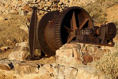
Lost Horse Mine: You can do this hike as an up-and-back to make it a 4 mile hike or do it as a loop for 6.2 miles. It’s a moderately strenuous hike that gives you some great views of the park as you climb, as well as a great visit to an old gold and silver mine, complete with tipple and mill ruins. NPS Map


Pine City: A 3.5 mile up-and-back hike to the only pine trees in the park. A moderate hike that has options to make it much longer. The trail leads to a collection of giant boulders shaded by California Juniper and Pinon Pine trees. A wonderful place for lunch as you sit beneath the shade of the trees and boulders. The “city” was apparently a small collection of wooden cabins inhabited by miners who worked the nearby Lucky Boy Mine. LOCALHIKES: Pine City


Barker Dam / Petroglyphs Loop: An easy hike of maybe 1.5 miles. It is my favorite to take as the last hike of the day. The setting sun casting a warm glow on the rock faces. You are more likely to see a few critters visit during this time as well. The trail takes you to the small lake created by a dam built to hold water for cattle then into a boulder lined valley. There is a small side track to the “Movie Petroglyphs” named so because a movie crew enhanced ancient petroglyphs with some paint to make the filming of them easier. MODERNHIKER: Barker Dam Loop


Hidden Valley Nature Trail: This easy hike is only 1 mile but is a complete delight. This small valley is home to an abundance of life. Do not pass it up. PROTRAILS: Hidden Valley Loop