Showing posts with label loop hike. Show all posts

Sunday, August 14, 2011

Aliso and Wood Canyons: A hike in 3 acts

"Aliso and Wood Canyons Loop"
11 Mile loop hike
900' Elevation gain/loss
Moderately Strenuous

The OC Park system should be mighty proud because they are mighty clever. No doubt by design, many of the system’s wilderness areas are truly citadels of open and very wild spaces bumping up to the backyards of expansive and expensive housing developments. The Aliso and Wood Canyons Wilderness Park is no exception and may indeed be the prototype for such planning.

The park with its rambling name is almost 4,000 acres of former Spanish land grant ranchos hosting rolling hills, flat meadows and lush canyons and is positioned within long-walking distance from the Pacific Ocean as it overlooks the town city of Laguna Beach. What also distinguishes this park from many of its local cousins is its offer of a hike longer than just a few miles.  But like any in the park, the first and third acts of these hikes are at best, a dull production. However the long second act more than makes up for that blandness.

Begin your hike at the parking lot of the Visitor Center that is worth a quick peek.  Be sure to check out the fossils found in the sandstone and limestone formations that exist in the park. There’s a $3.00 parking fee, payable with a credit card. Portable toilets with hand washing facilities are adjacent to the lot. There may be running water for drinking somewhere, but I didn’t see any.

Just past the Center is the paved trailhead leading to the mouth of Aliso Canyon along Aliso Creek Trail.  The paved road is actually an access for the Also Water Management Agency and as such is a private road. Its open all weekend but reportedly there have been times when its closed during the week because of work being done on the parallel running creek. This portion, or first act, of the hike is unremarkable. Families with strollers or children on bicycles will find the wide, flat road useful and pleasant to enjoy but for the hiker or mountain biker, its just whatcha gotta do to get to the good stuff.

The good stuff lies just 1.5 miles beyond the parking lot trailhead at the clearly marked trailhead for Wood Canyon Trail.  I know of some hikers who will ride their bikes to this junction and lock them up on the handy bike rack located there.  Portable toilets are also located here, but again, no running water.

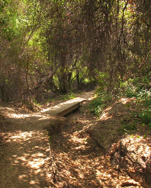
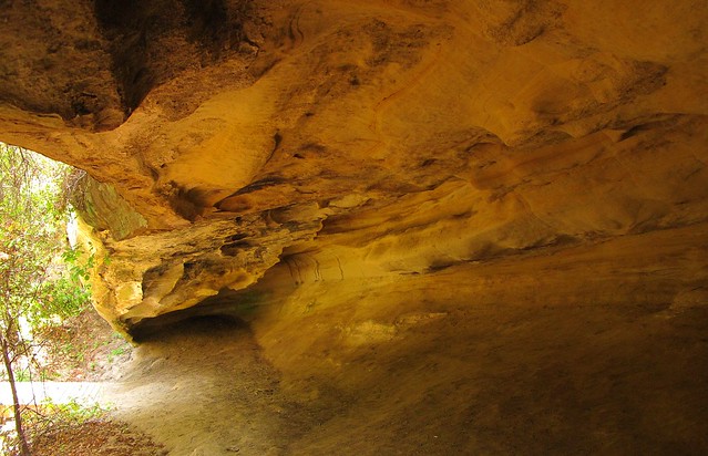
Follow Wood Canyon north for about .75 miles to the Dripping Cave junction which will be on your left and clearly marked like all of the trails at the park. It’s a short jaunt to the cave that you’ll find just beyond a wooden footbridge. 

SIDE TRAIL: Before reaching Dripping Cave, you’ll see signs leading to Cave Rock, a substantial limestone formation eroded by wind and water to form several small caves. You’ll be able to see the rock if you stay on the main trail so there’s no real need to take the side trail unless you really want to.

After reading about how the cave was the supposed hideout of 19th century bandits, return towards the footbridge but instead of crossing it, veer to the left (north) trail that leads toward Mathis Canyon.  The trail becomes a bit steep for about 150 yards before it drops down again into a lovely meadow residing in the bottom of Mathis Canyon.  Before reaching the meadow, you’ll see even more caves as you walk beneath a cool oak canopy.  After crossing the eastern edge of this canyon meadow, you’ll intersect with Mathis Canyon Trail.  This is the last shade you’ll have for a while and the hike becomes much more challenging. 

SIDE TRAIL: Before the climb, note the side trail to Oak Grove. Though overlooked by most, the grove resides in a narrow ravine that offers a bit of solitude from the rest of the folks on the trails. Deep and shady, I consider this a destination for a shorter, up-and-back 6-mile hike.  The adjacent rock formations also make it particularly worthwhile.

Mathis Canyon Trail provides a 550’ elevation gain in approximately 1.25 miles. It’s steep with few level, catch-your-breath sections until near the very end of the climb to the West Ridge Trail. At the junction of Mathis and West Ridge, turn right (north) on the wide fire road trail. Expect lots of other folks to also be there, many of whom started at the Alta Laguna Park in Laguna Beach.

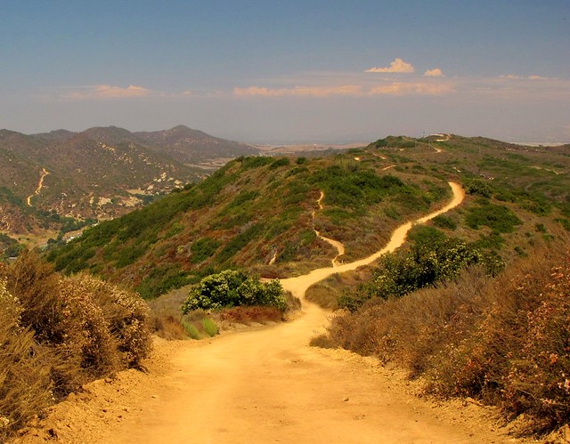
The undulating ridge is a welcome walk after the climb to reach it. The views and breezes up there contain elements of the nearby ocean making it very pleasant.  Continue north on the ridge past the cell phone towers and water tank until you reach the Lynx trail on your right.  Take a moment to sit on the convenient rock at this junction to retie your shoes before making the descent back into Wood Canyon.  You’re about at the halfway mark of the 11 miles at this point. Parts of this downhill, single-track trail are steep and slick. Since you may also encounter bicyclists on this trail, be extra cautious.

At the bottom, you’ll intersect with Wood Canyon Trail and a right turn will bring you back to your starting point. If you brought a snack or a lunch, I’d find a shady spot here. There’s no more climbing to do, a sweet stream whispers nearby and there's lots of shade from the giant, spreading oaks found in the canyon. The entire scene makes for a nice place to regroup your thoughts, cool off from the exposed ridge and loosen up those boots if you like.

SIDE TRAIL: Hiking-only trails (Wood Creek Trail and Coyote Run Trail) parallel the main, shared use Wood Canyon trail. Signs show how to access them from Wood Canyon.  The upside of using these trails is that you won’t be dodging bikers but the downside is that you may find the creek a bit further away at times and perhaps a little less shade is offered, especially on Coyote Run.
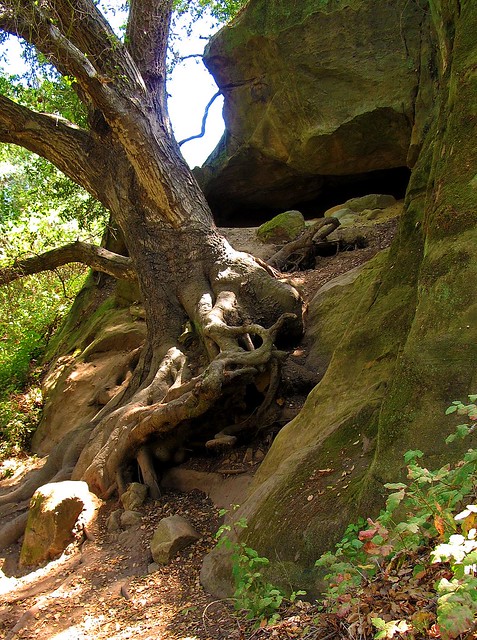
Follow the Wood Canyon Trail southeast back towards Aliso Canyon and eventually the parking lot from where you started. The trail follows along Wood Creek that was still flowing with an impressive amount of water in August. You’ll cross the stream three times before once again reaching the Dripping Cave trail junction.  From there, your hike enters its third and final act as you rejoin the paved water management access road.  It’s during this last 1.5 miles that I’ll plug in my Nano and unwind as I listen to some nice music and soften my pace before reaching my car to drive home.


A tip of my Tilley hat once again to the OC Parks system.  Aliso and Wood Canyons Wilderness Park did what it was designed to do; provide me with an open sky and miles to hike beneath it without having to travel far to reach it all.


Helpful Links:


Monday, February 21, 2011

Rock and Awe; Best day hike in Joshua Tree NP

My first visit to Joshua Tree National Park was when it was still designated as a National Monument, nearly 45 years ago. Then and even now, I considered it a truly alien landscape as my eyes and imagination tried to take it all in; the massive boulders, expansive cliffs and the tentacled trees for which the park is named seemed to be from another place, far removed from the mere two-hour drive from home. But it is a very real place, deserving of its National Park status as unique and worthy of preserving for many more generations.

Hiking opportunities are numerous and include wide groves of Joshua trees, mysterious hidden canyons, desert washes, grottos and high ridges. Rock climbing is very popular here due to the impressive boulders and inselberg rock formations, most of which are comprised of quartz monzonite, a very rough, large crystalline form of granite.  Camping is primative, that is to say, no flush toilets, electricity or waste hook ups.  That does not discourage the many who visit and stay. It is not uncommon to find all sites filled to capacity during spring bloom weekends.  But I come for the hiking now. My climbing days are 35 years and 35 pounds ago. Because the trails here are so rewarding, I rarely miss scaling the rocks here.

After reading a few reviews of what was described as “The Best Day Hike” in the park, it was decided that this trail would be perfect for the next trip to the park. The reviews of this loop hike are right on target, even if the mileage estimates vary from 6.2 – 7 miles, as this has become my new favorite hike in the high desert.  When inquiring about this hike, it's best just to call it "North View-Maze-Window Rock" after the three trail segments that make up this particular loop.

The hike has been known of for quite some time, but until recently it required some orienteering skills to complete. The entire hike with it’s various loops and trail junctions are now well marked and signed. Anyone with moderate hiking experience will be able to finish the hike according to the prescribed route. However at times, the trail becomes “subtle” as it crosses over barren rocks and through washes susceptible to the smoothing out of boot tracks and cairn scattering. If you pay attention, carry a trail guide with a simple map you’ll be fine. If you wander off trail to take advantage of a photo op or to water the plants, be mindful of where the trail is at behind you. In some sections, the trail is virtually invisible unless you were directly on it.

Finding the trailhead is a little tricky as it is not well marked. The 3-4 car maximum parking area (called by some the “borrow pit” lot because of a nearby old gravel pit) is located immediately north of roadway marker 24 near the park’s west entrance.

This loop hike takes advantage of three trails, North View trail, Maze loop and Window Rock loop. Each trail section provides it own character which makes this hike compelling and anything but boring. The North View trail offers spectacular views of the village of Joshua Tree, Twentynine Palms and Copper Mountain. The views are framed with stacked boulder fins and naturally formed cairns.

The Maze loop leads you through low slot canyons, again built from stacked boulders, accented with cactus and juniper. The Window Rock loop presents a visual oddity in the form of a high rock window that at times will appear to be a large winged bird or just a square-like opening near a ridge line depending on your angle of view. Bighorn Sheep are readily spotted on this trail which also takes you through spreading groves of Joshua trees.

In short, it’s all here. Just about all of the visual, wildlife and floral attractions of the park can be found within this moderate difficultly loop hike. I can’t recommend it highly enough. This is the kind of hike that defines why I love to walk under open skies on paths unpaved.


A few guidebooks, “Afoot and Afield in the Inland Empire” by David and Jennifer Harris and “On Foot in Joshua Tree National Park” by Patty Furbush, describe the hike in more detail. Because the hike is still not high on everyone’s trail radar list, online resources are not abundant, but I did find these two nice references;

"Afoot and Afield" Book Excerpt

Trimble Outdoors Trail Guide

Thursday, May 27, 2010

Multnomah-Wahkenah Falls Loop

Multnomah-Wahkenah Falls Loop
Columbia River Gorge, Oregon
6.3 miles - 1,600 elevation gain
Moderately Difficult

Multnomah Falls is arguably the second most recognizable feature of the Columbia River Gorge. The first is the river itself. This iconic spectacle is a popular tourist destination due to its beauty and comfortable tourist accommodations including a sit down restaurant, fully loaded gift shop, paved walkways and flush toilets. Highway access is quick and easy. There could be no better place for locals to bring visitors to Portland when wanting to truly impress them with the area’s natural beauty.

Most folks will take the ½ mile walk to the base of the first fall to peer upward from the circa 1914 concrete constructed Benson Footbridge. A number of others may even venture a bit more to peer dizzyingly over the upper fall’s cascade though it can produce some gasping breaths from those unaccustomed to steep walking. Even fewer take the opportunity to see some of the other wonderful falls higher up the gorge’s talus slopes and into the thick rainforest, which is exactly what I wanted to do during a recent trip to Portland to visit family and friends.

Depending on who you ask and which trail map you pick up, the Multnomah-Wahkenah Falls Loop hike is known either as Loop #1 or Loop #2. This map shows the route as Loop #2. Many of the hiking guides tell you to trek this in a clock-wise manner, from Multnomah Falls towards Weisendanger Falls but I would advise you to take this route in the opposite direction. Due to the crowds on the Multnomah Falls walkway (I’m hesitant to call this section a "trail," since it’s nicely paved, wide and well engineered. I spied many folks walking in flip-flops along the steep grade) I recommend saving this human traffic jam to the end of the hike. It would be a shame and misleading to allow this to set the tone for the remainder of the trek.

The hike is well documented on other sites including; Oregon.com Multnomah Falls Guide and Tripcart.com Multnomah Falls Guide
which give varying accounts of mileage and difficulty. In rechecking my calculations, the hike with side steps to lookouts and such is right at 6 miles with an elevation gain of approximately 1,600’.

Begin and end the hike at the Multnomah Falls Lodge. From the falls proceed west, past the lodge and parking area as you parallel the Historic Columbia River Highway until you reach Wahkenah Falls. Begin your climb up the gorge’s south wall as you travel a good distance along Wahkenah Canyon creek. The canyon fills your ears with the music of the rushing creek, as moss draped pines and deep green ferns saturate your eyes. I honestly don’t think I’ve ever hiked in a more beautiful forest setting.

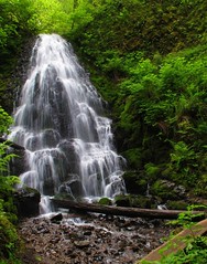
The climb up-canyon continues for about 2.7 miles until it levels off on the southern slope of the gorge. Along the way you’ll discover Fairy Falls, a lovely fan waterfall that invites many photos to be taken. Near the high point of the hike, you’ll have opportunities to visit Devils Rest, another 1.6 miles and Larch Mountain, an additional 5 miles from the trail junction.

When you begin to descend north along Multnomah Creek, several more small waterfalls are found including Wiesendanger and Ecola falls. Though the scenery remains spectacular, it is along this section of trail that you’re likely to encounter more hikers who’ve come up from Multnomah Falls, the number of which will increase to distraction and irritation until you reach the main lodge again.

I’m definitely repeating this hike on subsequent visits to the area but will also strive to summit Larch Mountain next time. From the photos and trail guides I’ve read, it should prove to be a rewarding experience. The top of the mountain is similar to a bald; unprotected by trees thereby offering unobstructed views for miles in all directions.

In addition to the other charms of the area, both in terms of the inhabitants and environs, this hike will be just one more reason to return. And soon.