Showing posts with label national parks. Show all posts

Wednesday, March 16, 2011

Best Day Hike in Lower Sequoia NP: Marble Falls Trail

Sequoia National Park is more than just big, fat trees. For certain, those fatties are worth seeing, touching and loving anytime and often, but winter visits are sometimes made a bit more difficult with closed highways and neck deep snow covered trails. Fortunately, Sequoia offers diverse environments allowing treks year round.


Approaching the park from the south via Hwy 198 through Visalia and Three Rivers, the “Ash Mountain and Foothills” portion of Sequoia is often well below the snow line while still providing inspiring waterfalls, roaring rivers, oak and laurel shaded paths and encounters with wildlife regardless of the season.


One of the more popular trails there is the 8 mile round trip hike to Marble Falls.  The trail is a moderately difficult hike with a 2,000 foot elevation change.  To access the trailhead, enter the park from the southern gate, (Ash Mountain) driving north-easterly on the park’s Generals Highway to the Potwisha campground, elevation 2,100 feet.

Entering the campground, continue along its roadway to the upper, northern end (near campgrounds 14 and 16) where a narrow access road leads to a small parking area.  Since bears frequent the area, a metal “bear box” is available at the trailhead to safely store any coolers, food and toiletries carried in your car. 

Though you may not actually see a bear, it is highly likely you’ll see evidence of their presence in the form of scattered trash, fecal matter, scarred tree trunks and other signs.  Be smart and use the bear box.

The trail parallels a concrete aqueduct and the Marble Fork of the Kaweah river for .2 miles before it begins a quick, switched-back climb on the east side of the river gorge. New trail signs indicate that from this point, the falls are 3.9 miles up canyon, and I believe it.


Oaks, laurels and yucca dominate the chaparral plant life that is accented in the spring with wide swatches of wildflowers. The trail continues to climb as it follows the contours of the river gorge. This is my favorite type of hike since the trail alternates between climbing and leveling off. This allows you to rest while moving to the next uphill section of the hike.


As the trail climbs, the terrain and plants change to more alpine-like with occasional bare rock outcroppings that provide a particular drama to the often narrow, steep drop-off single-track trail. During the wetter months and the spring thaw, you will need to cross any number of hillside creeks that exist in draws. The trail is also alternatively shady and sun drenched as it moves in and out of these foliage and even moss-dense sections of trail.


At about 2.5 miles you will be afforded a distant, but good view of the falls, actually a series of cascades of varying heights, at the bottom of the narrow gorge. You will definitely hear the river and the falls before you see them and the roar only grows more powerful as you near the end of the trail.

When you reach the place where the trail meets the river, you’ll be treated to up close views of the largest cascades as they wash over broad slabs of white marbleized quartz. Looking up at the west side of the gorge, you’ll witness a massive deposit of this quartz, the outcropping as tall as the mountain containing it, looming over the river. Though you might be tempted, it is not recommended to venture any further up river. The rocks are slick, the river powerful and any missteps, unforgiving.

After absorbing a bit of the energy echoing from every surface, return the way you came. During the spring and summer months, be sure to check yourself for ticks that like to hang out on shrubs and low laying flora. Keep an eye for passive, fearless mule deer and furtive rattlesnakes along the way.  Both are numerous at times. 

There are many online trail guides for Marble Falls if you need additional information. The park rangers at the Foothills Visitor Center can also provide you with the latest trail conditions.  Though it's an easy hike to find and follow, here's a map that may be useful: Sequoia NP Foothills Area. Other helpful maps can be found on this site as well.

It is important to mention that during the summer months, the foothills area of Sequoia can get quite warm so bring plenty of water, and wear a hat!

Monday, February 21, 2011

Rock and Awe; Best day hike in Joshua Tree NP

My first visit to Joshua Tree National Park was when it was still designated as a National Monument, nearly 45 years ago. Then and even now, I considered it a truly alien landscape as my eyes and imagination tried to take it all in; the massive boulders, expansive cliffs and the tentacled trees for which the park is named seemed to be from another place, far removed from the mere two-hour drive from home. But it is a very real place, deserving of its National Park status as unique and worthy of preserving for many more generations.

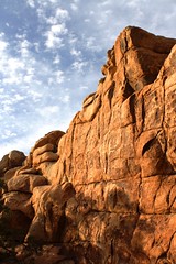
Hiking opportunities are numerous and include wide groves of Joshua trees, mysterious hidden canyons, desert washes, grottos and high ridges. Rock climbing is very popular here due to the impressive boulders and inselberg rock formations, most of which are comprised of quartz monzonite, a very rough, large crystalline form of granite.  Camping is primative, that is to say, no flush toilets, electricity or waste hook ups.  That does not discourage the many who visit and stay. It is not uncommon to find all sites filled to capacity during spring bloom weekends.  But I come for the hiking now. My climbing days are 35 years and 35 pounds ago. Because the trails here are so rewarding, I rarely miss scaling the rocks here.

After reading a few reviews of what was described as “The Best Day Hike” in the park, it was decided that this trail would be perfect for the next trip to the park. The reviews of this loop hike are right on target, even if the mileage estimates vary from 6.2 – 7 miles, as this has become my new favorite hike in the high desert.  When inquiring about this hike, it's best just to call it "North View-Maze-Window Rock" after the three trail segments that make up this particular loop.

The hike has been known of for quite some time, but until recently it required some orienteering skills to complete. The entire hike with it’s various loops and trail junctions are now well marked and signed. Anyone with moderate hiking experience will be able to finish the hike according to the prescribed route. However at times, the trail becomes “subtle” as it crosses over barren rocks and through washes susceptible to the smoothing out of boot tracks and cairn scattering. If you pay attention, carry a trail guide with a simple map you’ll be fine. If you wander off trail to take advantage of a photo op or to water the plants, be mindful of where the trail is at behind you. In some sections, the trail is virtually invisible unless you were directly on it.

Finding the trailhead is a little tricky as it is not well marked. The 3-4 car maximum parking area (called by some the “borrow pit” lot because of a nearby old gravel pit) is located immediately north of roadway marker 24 near the park’s west entrance.

This loop hike takes advantage of three trails, North View trail, Maze loop and Window Rock loop. Each trail section provides it own character which makes this hike compelling and anything but boring. The North View trail offers spectacular views of the village of Joshua Tree, Twentynine Palms and Copper Mountain. The views are framed with stacked boulder fins and naturally formed cairns.

The Maze loop leads you through low slot canyons, again built from stacked boulders, accented with cactus and juniper. The Window Rock loop presents a visual oddity in the form of a high rock window that at times will appear to be a large winged bird or just a square-like opening near a ridge line depending on your angle of view. Bighorn Sheep are readily spotted on this trail which also takes you through spreading groves of Joshua trees.

In short, it’s all here. Just about all of the visual, wildlife and floral attractions of the park can be found within this moderate difficultly loop hike. I can’t recommend it highly enough. This is the kind of hike that defines why I love to walk under open skies on paths unpaved.


A few guidebooks, “Afoot and Afield in the Inland Empire” by David and Jennifer Harris and “On Foot in Joshua Tree National Park” by Patty Furbush, describe the hike in more detail. Because the hike is still not high on everyone’s trail radar list, online resources are not abundant, but I did find these two nice references;

"Afoot and Afield" Book Excerpt

Trimble Outdoors Trail Guide

Wednesday, February 24, 2010

Favorite Hikes in Joshua Tree NP

Joshua Tree National Park is a most unique place and a special one in my history with the outdoors. I originally visited the park as a young Boy Scout when it was still a national monument. The massive boulders and other world qualities of the landscape gave rise to many wild imaginings and simple adventures.

As a young adult, I returned to climb monstrous boulders as I learned and then taught the basics of rock climbing. I would return many times to climb the rocks there, hone my skills and test my nerves. It would be the last place I would climb as well. February 18, 1989 was the last real climb I went on. I remembered it began to snow on a 3 pitch climb and my climbing partner and I had to rappel off the face to safety.

As an adult, I have returned to walk about the canyons, washes and ridges. Each visit brings new discoveries and new found appreciation for this most unique place. If you haven't been, you must see this place with your own eyes. It's a bucket list destination.

My current favorite hikes in the park are, in general order of preference:

Lost Palms Oasis: A 7.4 mile up-and-back that begins at Cottonwood Springs. For the first 3.2 miles, it is a moderate hike but increases in difficulty for the last .5 as you approach a deep canyon bearing a surprising number of California Palms. You can add an additional 1.5 miles by taking the Mastodon Peak loop, which intersects with this trail.

This hike provides a wide variety of terrains, views and fauna. The only thing it does not give you are Joshua Trees. PROTRAILS: Lost Palm Oasis


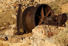
Lost Horse Mine: You can do this hike as an up-and-back to make it a 4 mile hike or do it as a loop for 6.2 miles. It’s a moderately strenuous hike that gives you some great views of the park as you climb, as well as a great visit to an old gold and silver mine, complete with tipple and mill ruins. NPS Map


Pine City: A 3.5 mile up-and-back hike to the only pine trees in the park. A moderate hike that has options to make it much longer. The trail leads to a collection of giant boulders shaded by California Juniper and Pinon Pine trees. A wonderful place for lunch as you sit beneath the shade of the trees and boulders. The “city” was apparently a small collection of wooden cabins inhabited by miners who worked the nearby Lucky Boy Mine. LOCALHIKES: Pine City


Barker Dam / Petroglyphs Loop: An easy hike of maybe 1.5 miles. It is my favorite to take as the last hike of the day. The setting sun casting a warm glow on the rock faces. You are more likely to see a few critters visit during this time as well. The trail takes you to the small lake created by a dam built to hold water for cattle then into a boulder lined valley. There is a small side track to the “Movie Petroglyphs” named so because a movie crew enhanced ancient petroglyphs with some paint to make the filming of them easier. MODERNHIKER: Barker Dam Loop


Hidden Valley Nature Trail: This easy hike is only 1 mile but is a complete delight. This small valley is home to an abundance of life. Do not pass it up. PROTRAILS: Hidden Valley Loop